 AI Image
About This Quiz
Shapes and shapes only—forty-eight of them—strewn from the Pacific to the Med. It’s map speed-dating: shape appears, you judge if it inspires. Continent enthusiasts hold that continents represent vibes; this one is peninsulas and angles and clever bays.
Look for the stretch of island that refuses to sit still, the teardrop off India, the long S along the coast. Mountains don’t reveal anything, but coastlines talk; capes and bays speak louder than any description. Even a small notch will be the giveaway.
Eyes > ego. If you think you know it, you probably do. If you don’t, steal a breath and spot the telltale notch. Ready to make geography blink first? Go.
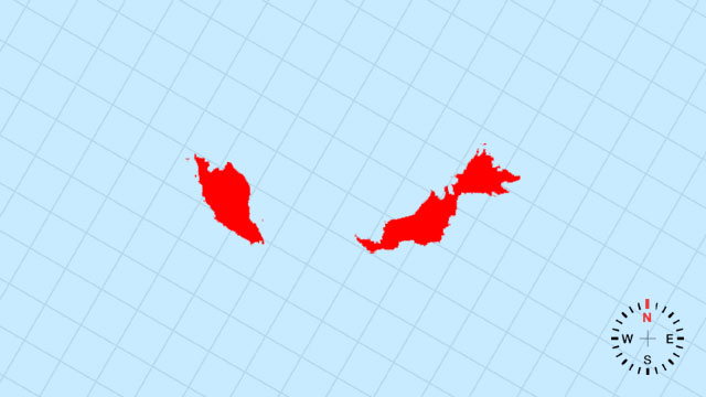
1. Which country’s outline is this?
[B] Malaysia | A slender, southward-stretching land-bar that splits into two uneven legs: the Malay Peninsula and Borneo’s rugged northwestern claw.
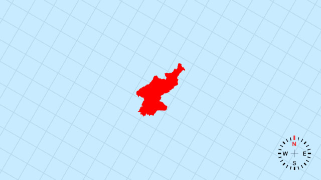
2. Which country’s outline is this?
[B] North Korea | A compact, northeast-tilted triangle whose western waist is pinched by Korea Bay and whose eastern spine is the Tumen River.
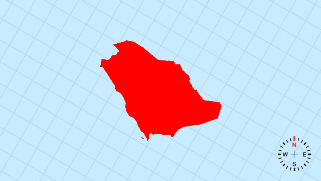
3. Which country’s outline is this?
[A] Saudi Arabia | An immense, west-sloping rhombus whose southwest edge is the straight Red Sea cut and whose eastern flank curves along the Persian Gulf.
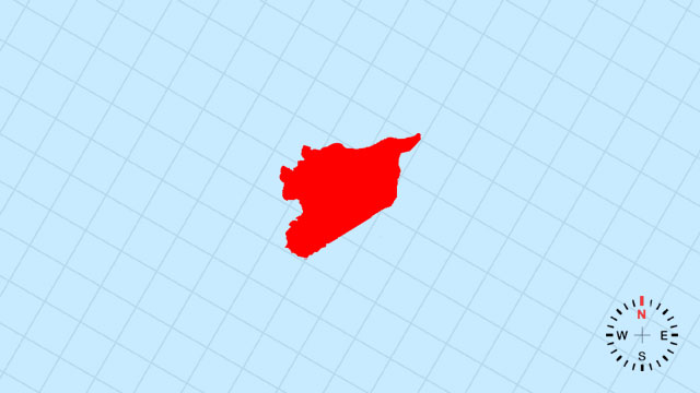
4. Which country’s outline is this?
[D] Syria | A roughly rectangular slab turned slightly eastward, its western coast a brief, straight Mediterranean bite.
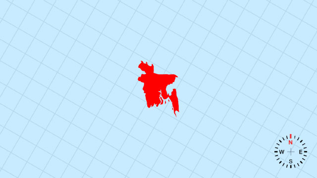
5. Which country’s outline is this?
[C] Bangladesh | A compact, east-leaning deltaic parallelogram, its northern top squared by India and southern tip frayed by the Bay of Bengal.
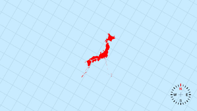
6. Which country’s outline is this?
[B] Japan | A north-south arc of four main islands—like stepping-stones—curving toward the Pacific, with Honshu as the longest stride.
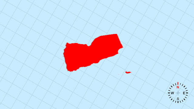
7. Which country’s outline is this?
[D] Yemen | A southwest-pointing wedge whose western edge is the long Red Sea scimitar and southern tip the Gulf of Aden hook.
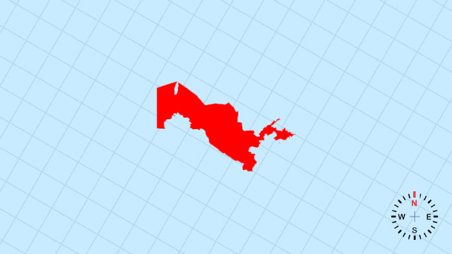
8. Which country’s outline is this?
[B] Uzbekistan | A doubly landlocked oval slightly dented on the west by the Aral Sea’s shrinking bite.
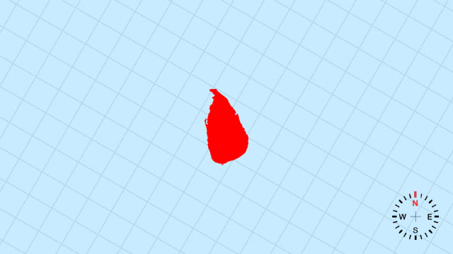
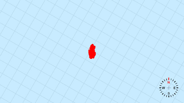
9. Which country’s outline is this?
[A] Sri Lanka | A teardrop pendant hanging just below India’s southern tip, its southwest coast rounded and northeast tail tapered.
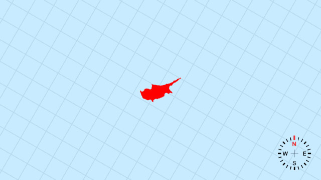
10. Which country’s outline is this?
[D] Cyprus | A small, northeast-tilted leaf floating in the eastern Mediterranean, its northern coast gently indented.
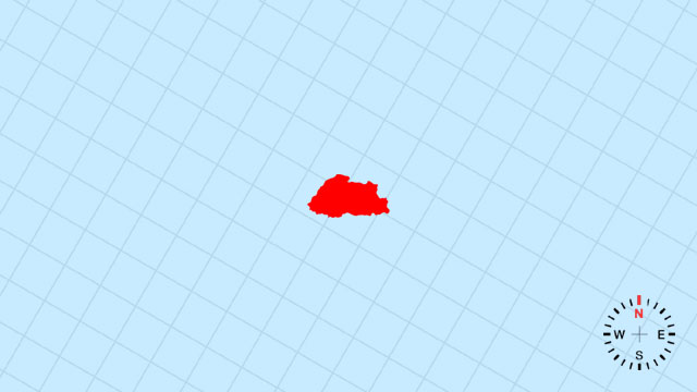
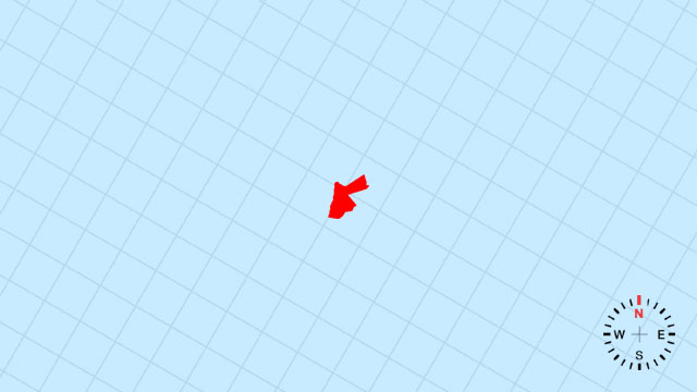
11. Which country’s outline is this?
[B] Bhutan | A tiny, east-west sliver tucked high along the Himalayas’ southern folds like a folded prayer flag.
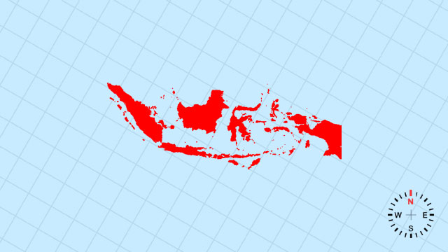
12. Which country’s outline is this?
[C] Indonesia | A sprawling archipelagic chain, thousands of islands strung like scattered pearls across the equator from Sumatra to Papua.
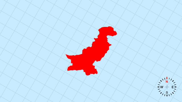
13. Which country’s outline is this?
[B] Pakistan | A north-south rectangle tilted northwest, its Arabian Sea coast a smooth diagonal cut.
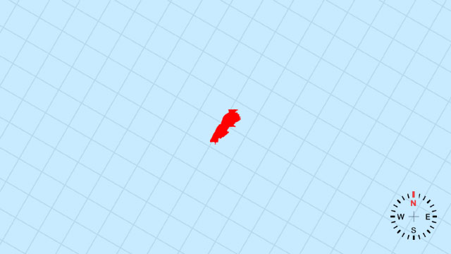
14. Which country’s outline is this?
[B] Lebanon | A narrow, north-south ribbon pressed between mountains and sea, barely wider than a coastline.
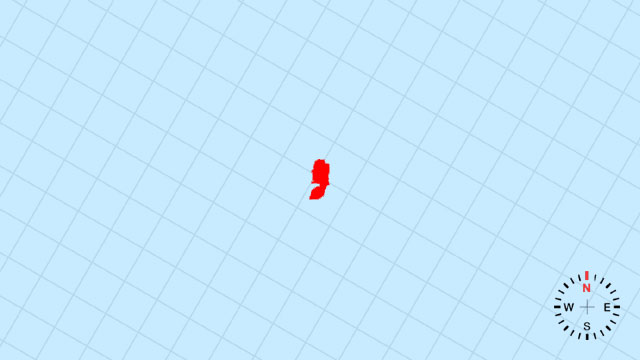
15. Which country’s outline is this?
[C] State of Palestine | A small, fractured patchwork on the western edge of the Jordan River, its outline interrupted by Israeli enclaves.
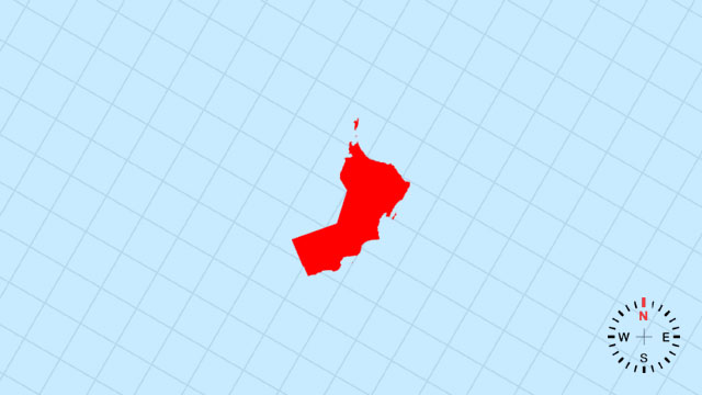
16. Which country’s outline is this?
[A] Oman | A southeast-pointing dagger whose blade is the long Arabian Sea coast and whose hilt is the Musandam Peninsula.
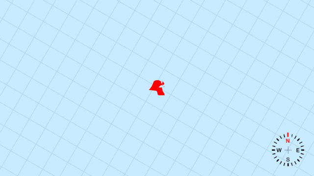
17. Which country’s outline is this?
[C] Kuwait | A tiny, northeast-facing rectangle snug against Iraq and the Persian Gulf’s northwestern corner.
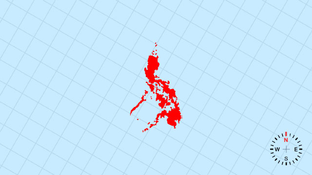
18. Which country’s outline is this?
[B] Philippines | An east-west scatter of more than 7,000 islands, like shards of a broken plate across the western Pacific.
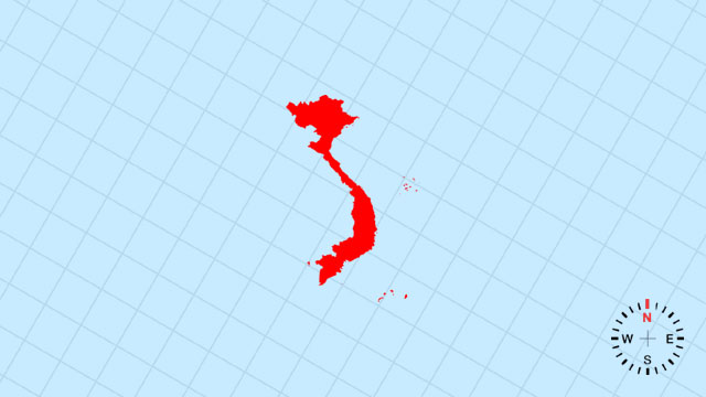
19. Which country’s outline is this?
[A] Vietnam | A long, sinuous S-curve hugging the South China Sea, tapering south to the Mekong delta.
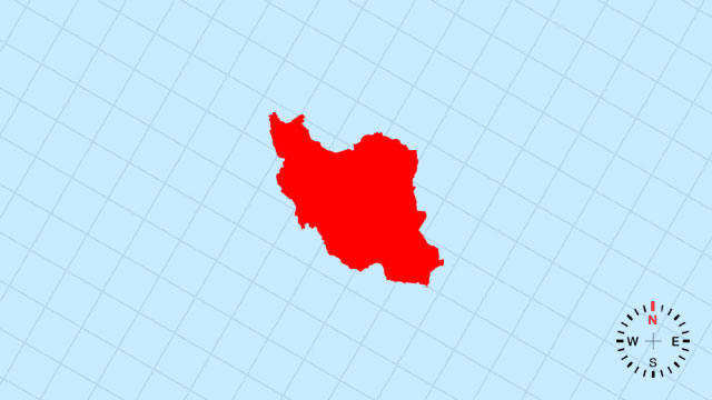
20. Which country’s outline is this?
[C] Iran | A broad, eastward-bulging shield whose southern edge is the long Persian Gulf arc and northern edge the Caspian lip.
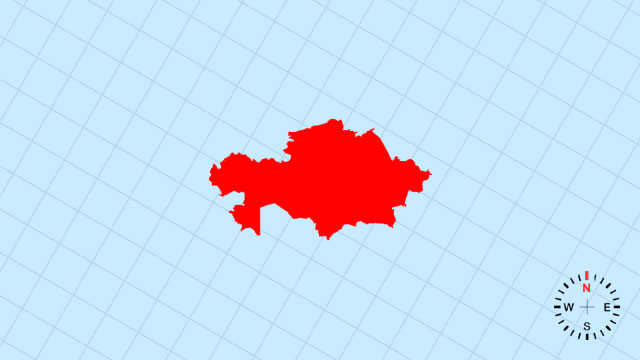
21. Which country’s outline is this?
[B] Kazakhstan | A vast, westward-sprawling quadrilateral, its northern side ruler-straight and southern rim scalloped by deserts.
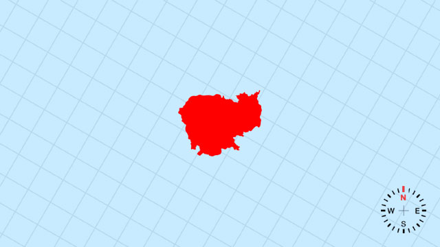
22. Which country’s outline is this?
[C] Cambodia | A compact, southeast-leaning diamond whose southwest corner is the Gulf of Thailand’s small bite.
23. Which country’s outline is this?
[D] Jordan | A near-square tilted slightly east, its western edge cut by the Jordan Rift and eastern edge the straight Arabian desert.
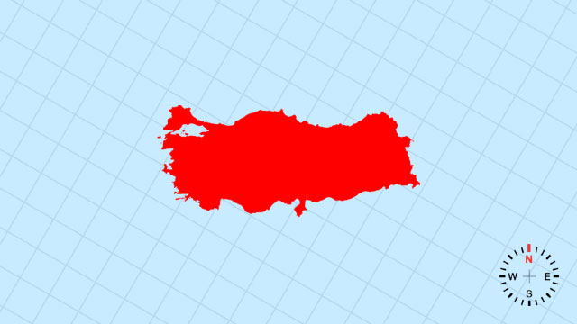
24. Which country’s outline is this?
[C] Turkey | A transcontinental bridge: the bulky Anatolian rectangle and the small European Thrace peninsula thumb.
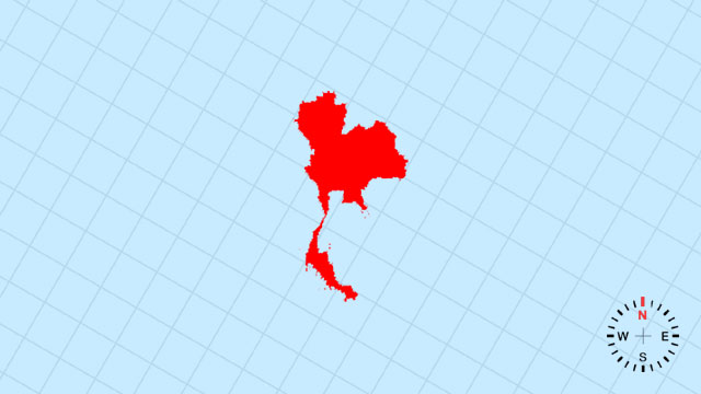
25. Which country’s outline is this?
[B] Thailand | A broad, south-pointing axe whose long handle is the Kra Isthmus and broad blade the northern highlands.
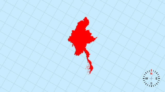
26. Which country’s outline is this?
[C] Myanmar | A large, southeast-tilting kite whose western coast is the Bay of Bengal’s ragged edge.
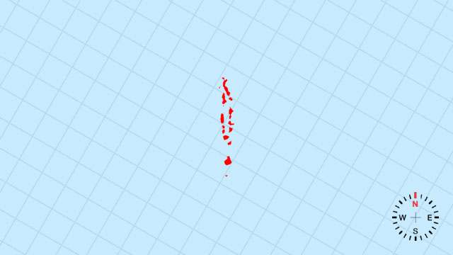
27. Which country’s outline is this?
[A] Maldives | A necklace of tiny coral dots strung across the equatorial Indian Ocean, barely visible on a world map.
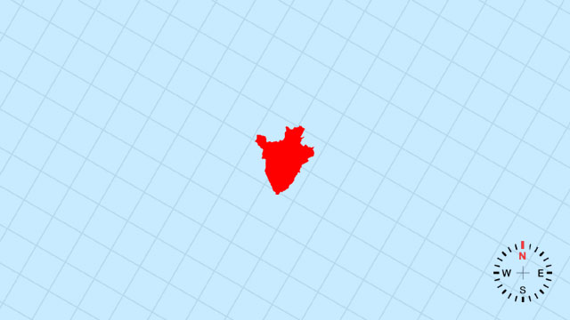
28. Which country’s outline is this?
[B] Brunei | A miniature sultanate split into two green puzzle pieces embedded in Borneo’s northwestern coast.
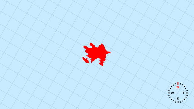
29. Which country’s outline is this?
[C] Azerbaijan | A compact, eastward-pointing comma whose curled tail is the Absheron Peninsula jutting into the Caspian.
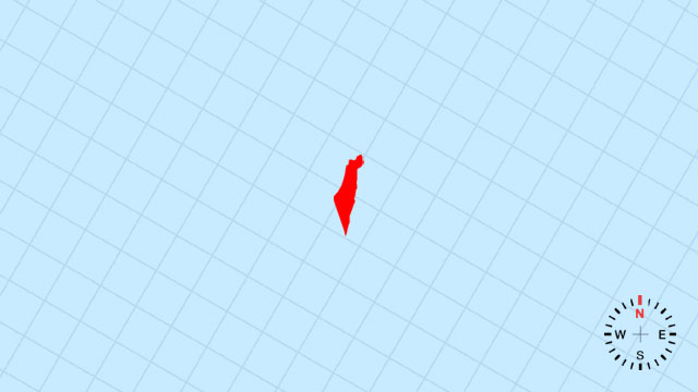
30. Which country’s outline is this?
[D] Israel | A narrow, north-south strip widening slightly into a southern Negev triangle and a northern coastal bulge.
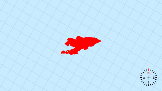
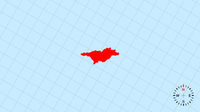
31. Which country’s outline is this?
[B] Kyrgyzstan | A petite, east-west lozenge locked high in the Tien Shan’s alpine embrace.
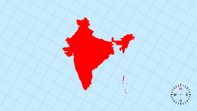
32. Which country’s outline is this?
[C] India | A vast, south-pointing triangle whose northern crown is the Himalayas and southern tip is the teardrop of Sri Lanka’s neighbor.
33. Which country’s outline is this?
[A] Qatar | A small, thumb-shaped peninsula jutting north into the Persian Gulf like a tiny Arabian hitchhiker.
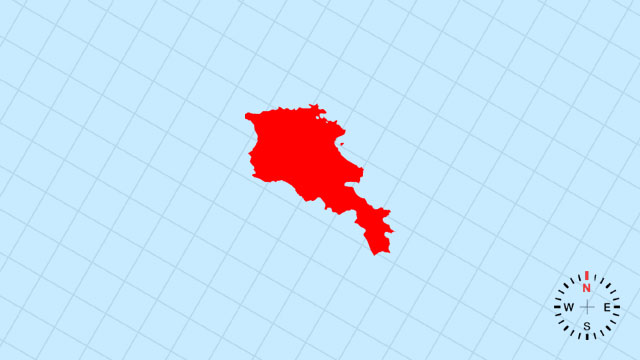
34. Which country’s outline is this?
[D] Armenia | A compact, landlocked diamond tucked between the Lesser Caucasus ranges.
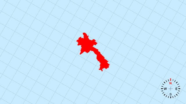
35. Which country’s outline is this?
[A] Laos | A land-locked, northeast-leaning parallelogram, its western edge carved by the Mekong’s slow curve.
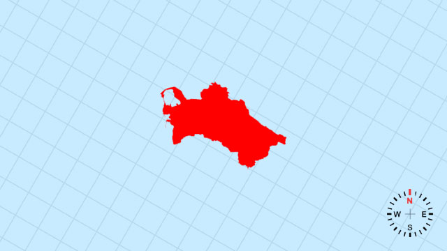
36. Which country’s outline is this?
[B] Turkmenistan | A broad, westward-tilted rectangle whose western coast is the straight Caspian shoreline.
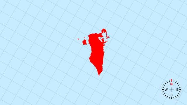
37. Which country’s outline is this?
[D] Bahrain | A tiny, irregular cluster of islands just off Saudi Arabia’s east coast, shaped like a broken cookie.
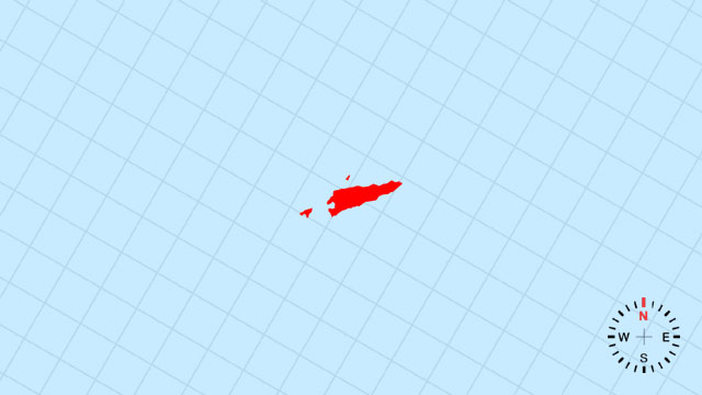
38. Which country’s outline is this?
[C] Timor-Leste | A sliver on the eastern half of Timor Island, its southern coast scalloped by the Timor Sea.
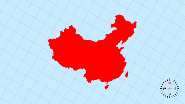
39. Which country’s outline is this?
[A] China | A colossal, west-east rooster silhouette stretching from the Pamirs to the Pacific, tail feathers in Xinjiang and beak at Shanghai.
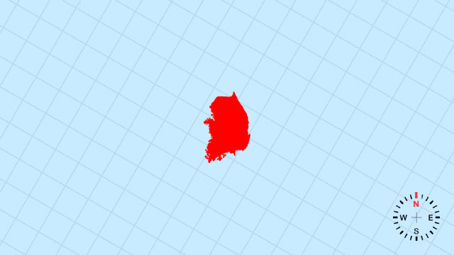
40. Which country’s outline is this?
[C] South Korea | A compact, southeast-tilting rectangle whose western coast is the Yellow Sea’s gentle curve.
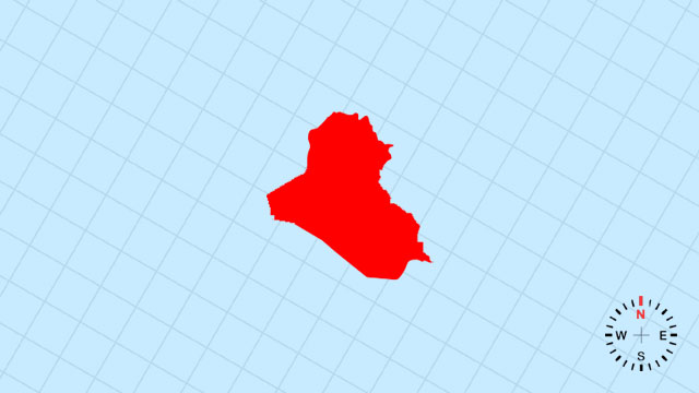
41. Which country’s outline is this?
[B] Iraq | A broad, eastward-leaning quadrilateral whose southern tip is the Persian Gulf’s small deltaic mouth.
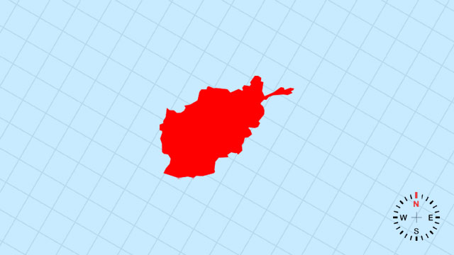
42. Which country’s outline is this?
[A] Afghanistan | A rugged, west-east rectangle pinched in the northeast by the Wakhan Corridor’s thin finger.
43. Which country’s outline is this?
[B] Georgia | A small, west-tilting parallelogram between the Black and Caspian Seas, its northern edge the Caucasus wall.
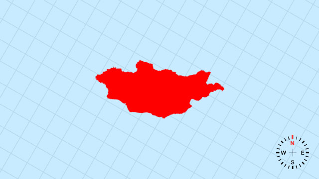
44. Which country’s outline is this?
[A] Mongolia | A vast, land-locked oval riding the high plateau between Russia and China like a steppe saddle.
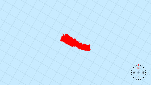
45. Which country’s outline is this?
[D] Nepal | A narrow, east-west rectangle climbing the Himalayas’ southern slope, its northern edge the world’s highest ridgeline.
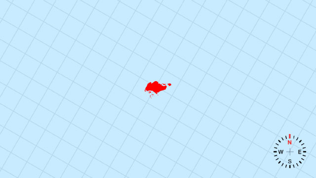
46. Which country’s outline is this?
[A] Singapore | A single, diamond-shaped dot at the tip of the Malay Peninsula, enlarged by reclaimed land at its edges.
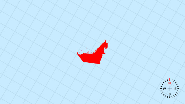
47. Which country’s outline is this?
[D] United Arab Emirates | A compact, south-east tilted wedge on the Persian Gulf, its eastern side nibbled by Oman’s enclaves.
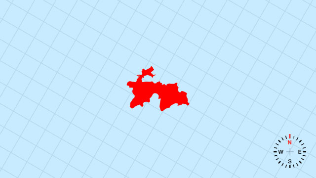
48. Which country’s outline is this?
[C] Tajikistan | A rugged, east-west lozenge folded by the Pamirs, its southeastern corner a jagged mountain claw.
Your Scorecard
48 Asian Map Outlines Quiz
- Correct
- Correct Rate%Avg Correct Rate
- L1Difficulty Level1xPoints
- Get Points
- Perfect100%
- Excellent≥90%
- Very Good≥80%
- Good≥70%
- Passed≥60%
- Failed≤50%
Recent Top Players
Related Quizzes
-
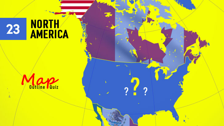
![23 North America Map Outline Quiz]()
23 North America Map Outline Quiz
23 QuestionsPlay Quiz -
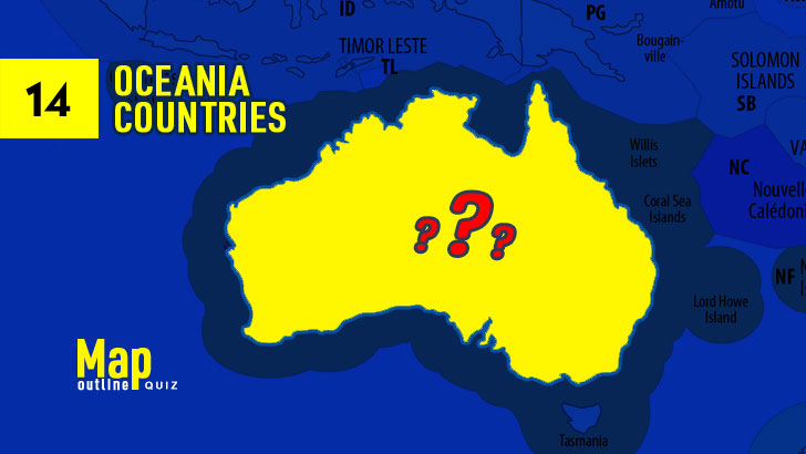
![14 Oceania Map Outline Quiz]()
14 Oceania Map Outline Quiz
14 QuestionsPlay Quiz -
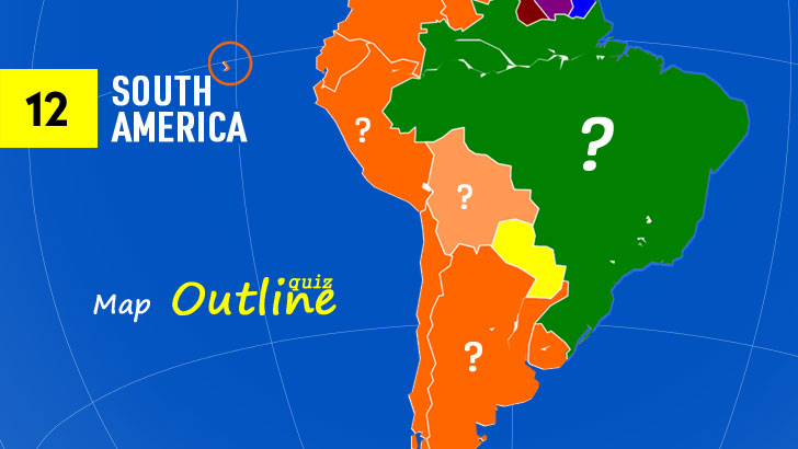
![12 South America Map Outline Quiz]()
12 South America Map Outline Quiz
12 QuestionsPlay Quiz -
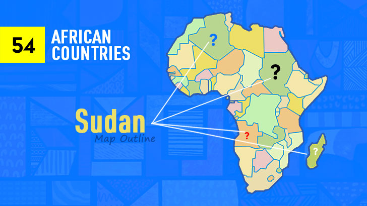
![54 African Map Outline Quiz]()
54 African Map Outline Quiz
54 QuestionsPlay Quiz -
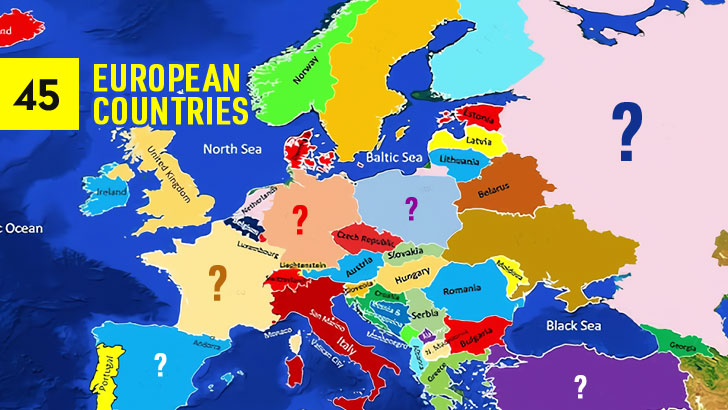
![45 European Map Outlines Quiz]()
45 European Map Outlines Quiz
45 QuestionsPlay Quiz -
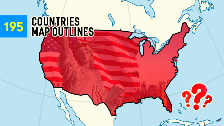
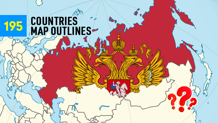
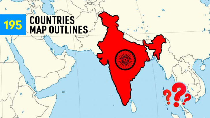
![Guess the 195 Map Outlines (Part 4)]()
Guess the 195 Map Outlines (Part 4)
45 QuestionsPlay Quiz -
![Guess the 195 Map Outlines (Part 3)]()
Guess the 195 Map Outlines (Part 3)
50 QuestionsPlay Quiz -
![Guess the 195 Map Outlines (Part 2)]()
Guess the 195 Map Outlines (Part 2)
50 QuestionsPlay Quiz
More from QuizABCD
-
![Guess Wrong, Get a Whole New Mutt (3)]()
Guess Wrong, Get a Whole New Mutt (3)
40 QuestionsPlay Quiz -
![90s Quiz: Guess the Song from the Pic!]()
90s Quiz: Guess the Song from the Pic!
20 QuestionsPlay Quiz -
![Can You Moonwalk Through This MJ Trivia? (3)]()
Can You Moonwalk Through This MJ Trivia? (3)
30 QuestionsPlay Quiz -
![100 Most Famous Logos Quiz (Random 50)]()
100 Most Famous Logos Quiz (Random 50)
50 QuestionsPlay Quiz -
![Cathedral Chaos: Letter by Letter]()
Cathedral Chaos: Letter by Letter
30 QuestionsPlay Quiz -
![AFI's Top 100: Count Down the Films (3)]()
AFI's Top 100: Count Down the Films (3)
40 QuestionsPlay Quiz -
![Only True K-Pop Stans Can Name 100 Idols (2)]()
Only True K-Pop Stans Can Name 100 Idols (2)
30 QuestionsPlay Quiz -
![12 Chinese Zodiac Signs Quiz (3)]()
12 Chinese Zodiac Signs Quiz (3)
12 QuestionsPlay Quiz


Trending Quizzes
This week-
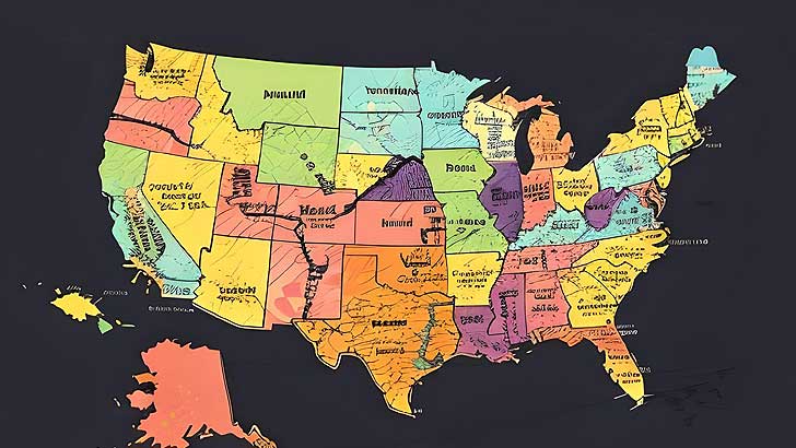
![50 U.S. States Map Quiz (Easy, L1)]()
50 U.S. States Map Quiz (Easy, L1)
000,000 Plays / 0,000 LikesPlay Quiz -
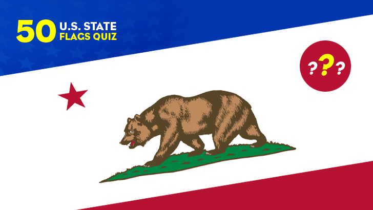
![50 U.S. State Flags Quiz (Easy, L1)]()
50 U.S. State Flags Quiz (Easy, L1)
000,000 Plays / 0,000 LikesPlay Quiz -
![]()
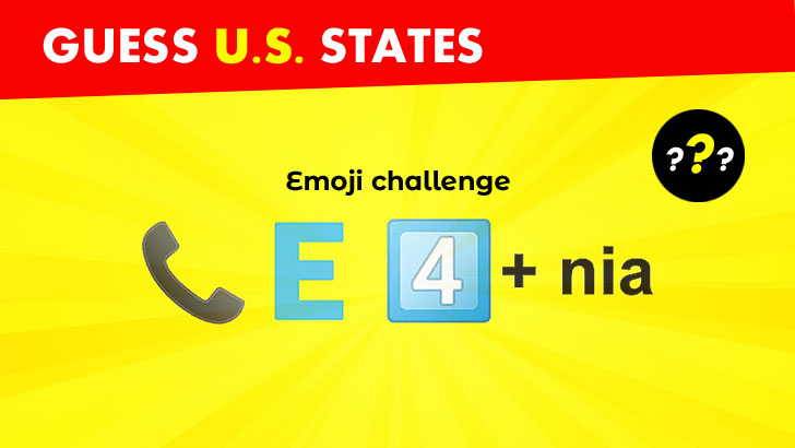
Guess 50 U.S. States from Emojis (1)
000,000 Plays / 0,000 LikesPlay Quiz -
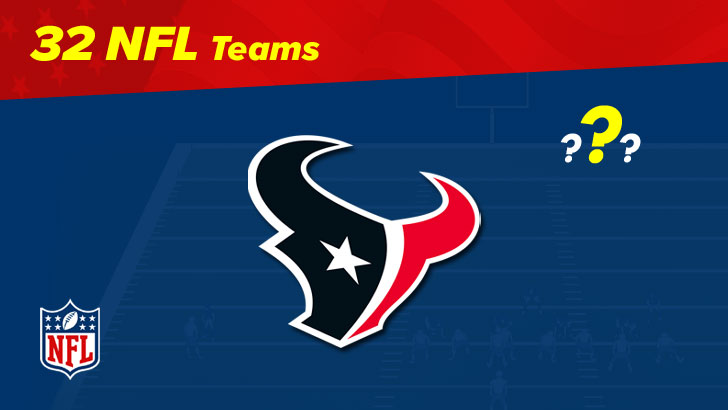
![32 NFL Team Logos Quiz (1)]()
32 NFL Team Logos Quiz (1)
000,000 Plays / 0,000 LikesPlay Quiz -
![30 NBA Team Logos Quiz (1)]()
30 NBA Team Logos Quiz (1)
000,000 Plays / 0,000 LikesPlay Quiz -
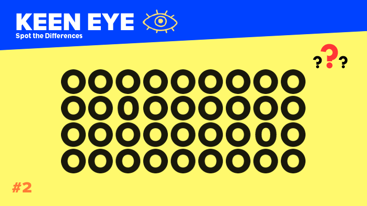
![Spot the Differences: Test Your Keen Eye!]()
Spot the Differences: Test Your Keen Eye!
000,000 Plays / 0,000 LikesPlay Quiz -
![]()
Identify 100 Greatest Music Artists Quiz (1)
000,000 Plays / 0,000 LikesPlay Quiz -
![50 Greatest TV Characters Quiz]()
50 Greatest TV Characters Quiz
000,000 Plays / 0,000 LikesPlay Quiz -
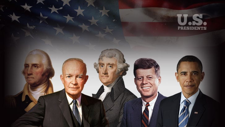
![U.S. Presidents Quiz: by Timeline]()
U.S. Presidents Quiz: by Timeline
000,000 Plays / 0,000 LikesPlay Quiz -
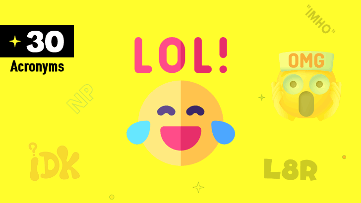
![30 Common Chat Acronyms Quiz]()
30 Common Chat Acronyms Quiz
000,000 Plays / 0,000 LikesPlay Quiz