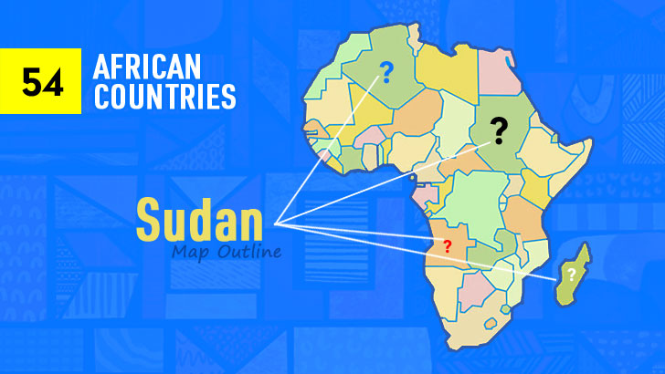
 AI Image
About This Quiz
Pointy edges, odd-notchery, and that Horn-shaped bend—meet silhouette speed-dating. One profile yelps landlocked plateau, another drags a coast around like a scarf, then. the giant one with that southeastern “bite.”
Cocky? Be cautious. Neighbors are fond of cosplay. A blobby box may conceal a kink in the river; the boomerang on the east ain’t who you imagine at first glance. Search for the tell: an extra peninsula, a pair of lakes, or that pesky border nick protruding like a paper tag.
Click clean, don’t second-guess (do—fast). Miss once, readjust. When the edges are whispering their names, you’re gone—racing past the decoys.
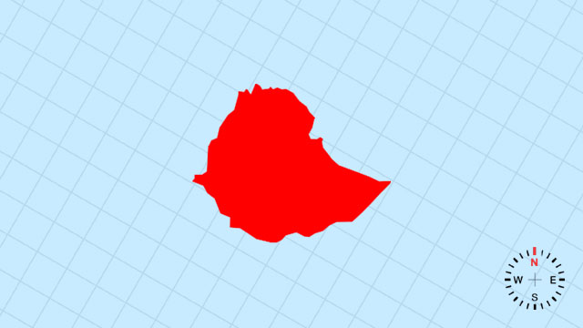
1. Which country’s outline is this?
[D] Ethiopia | A rugged, north-tilted triangle whose eastern horn points toward the Red Sea and whose western edge is sliced by the Great Rift Valley.
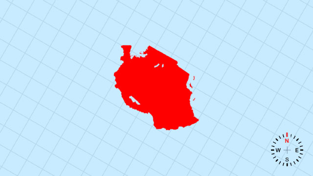
2. Which country’s outline is this?
[A] Tanzania | A broad, east-facing rectangle kinked on the right by the slender triangle of Zanzibar and the Indian Ocean bite.
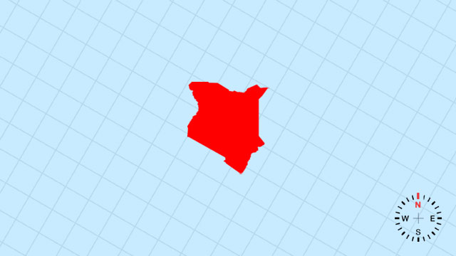
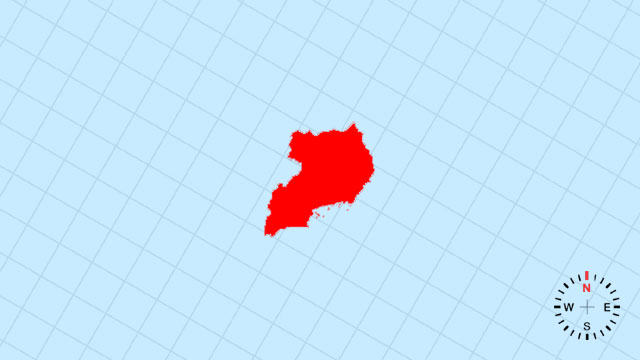
3. Which country’s outline is this?
[B] Kenya | A southward-leaning oval, its southeastern coast gently scooped by the Indian Ocean and northern frontier straight as a ruler.
4. Which country’s outline is this?
[C] Uganda | A compact, west-tilting oval cradling the northern shore of Lake Victoria like a cupped hand.
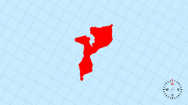
5. Which country’s outline is this?
[D] Mozambique | A long, south-running ribbon pressed between the Indian Ocean and the rugged spine of the interior.
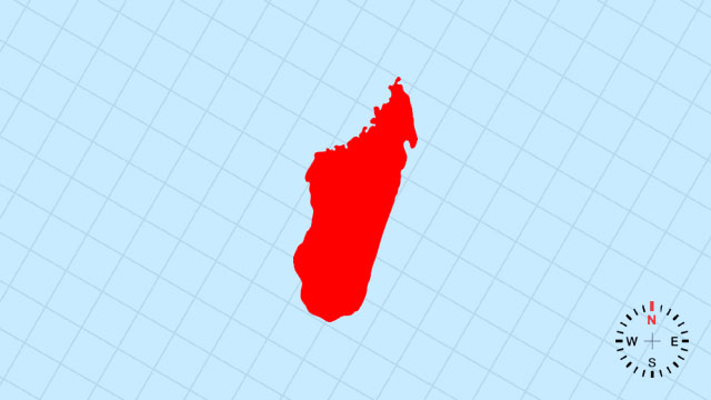
6. Which country’s outline is this?
[C] Madagascar | A giant, left-leaning leaf drifting east of Africa, its western edge smooth and eastern coast deeply serrated.
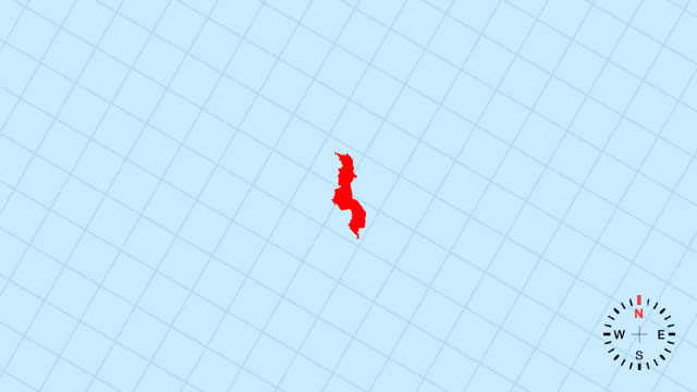
7. Which country’s outline is this?
[B] Malawi | A thin, north-south sliver whose eastern edge is the long, narrow claw of Lake Malawi.
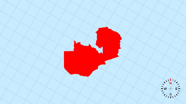
8. Which country’s outline is this?
[A] Zambia | A rough, eastward-slanting rectangle with a concave southern bite carved by Zimbabwe’s Zambezi bend.
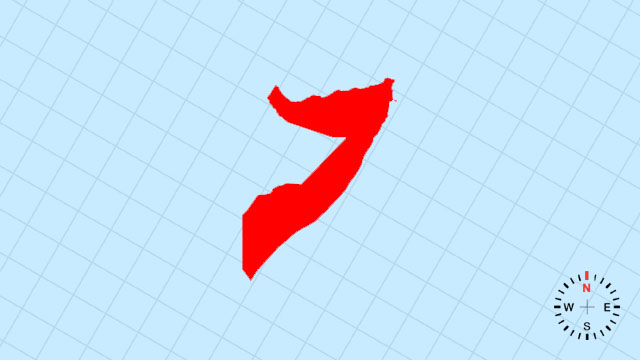
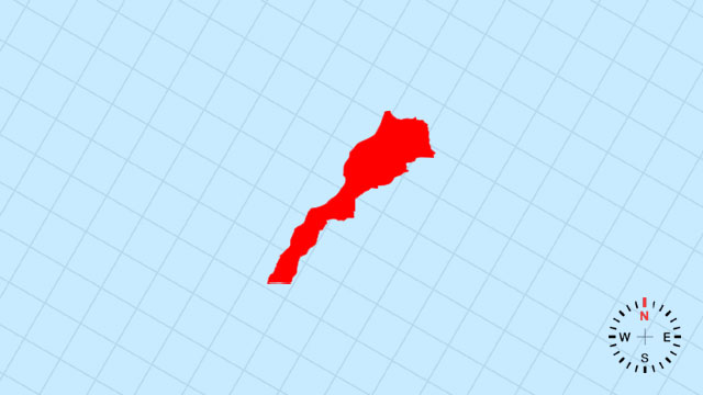
9. Which country’s outline is this?
[D] Somalia | A bold, eastward-leaning horn jutting deep into the Indian Ocean, its tip the Guardafui Cape.
10. Which country’s outline is this?
[B] Zimbabwe | A squat, east-tilted square with a northwestern wedge sliced out by Zambia’s Zambezi.
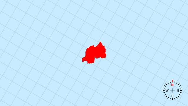
11. Which country’s outline is this?
[A] Rwanda | A tiny, landlocked diamond tucked high in the Albertine Rift, barely wider than its mountain ridges.
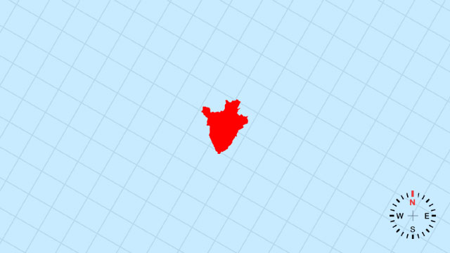
12. Which country’s outline is this?
[B] Burundi | A miniature, north-south lozenge pressed between Rwanda and Tanzania, its western edge the narrow Tanganyika shore.
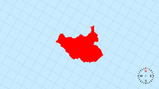
13. Which country’s outline is this?
[D] South Sudan | A broad, eastward-leaning parallelogram whose northern border is the looping Nile.
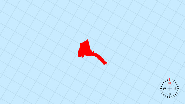
14. Which country’s outline is this?
[C] Eritrea | A slender, northeast-pointing spearhead along the Red Sea, its coast ruler-straight and inland edge jagged.

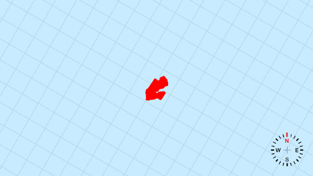
15. Which country’s outline is this?
[B] Mauritius | A tiny volcanic dot in the Indian Ocean, shaped like a broken teardrop with a southern coral tail.
16. Which country’s outline is this?
[D] Djibouti | A compact, northeast-leaning wedge wedged between Eritrea, Ethiopia, and the narrow Bab-el-Mandeb strait.
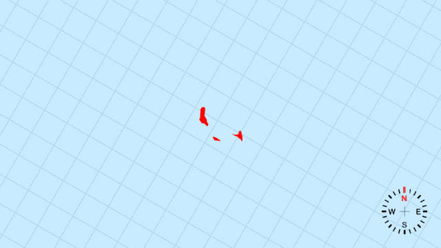
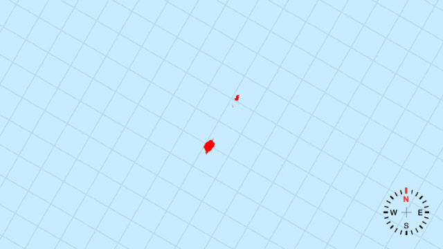
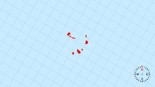
17. Which country’s outline is this?
[A] Comoros | Three small emerald dots scattered northwest of Madagascar, like stepping-stones across the Mozambique Channel.
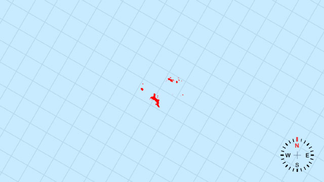
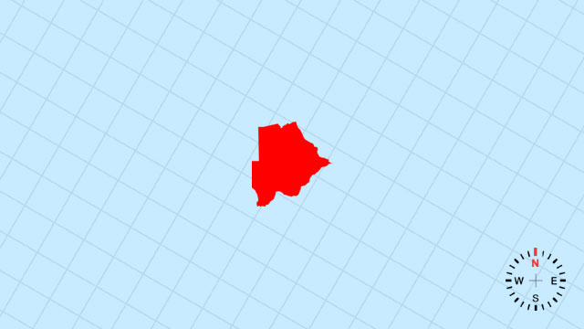
18. Which country’s outline is this?
[A] Seychelles | A handful of granite and coral flecks sprinkled across the western Indian Ocean, barely a thumbprint on the globe.
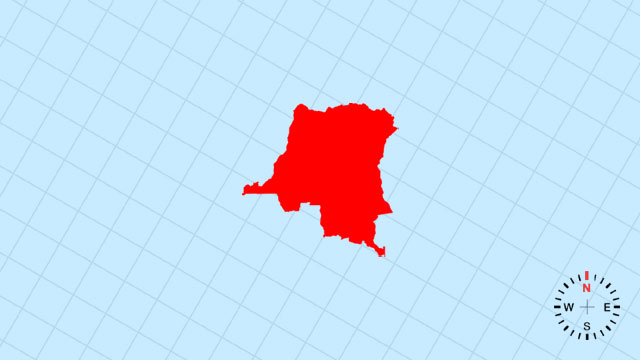
19. Which country’s outline is this?
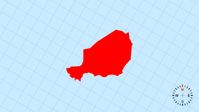
[B] DR Congo | A massive, westward-bulging heart whose center is the Congo Basin and whose western mouth kisses the Atlantic.
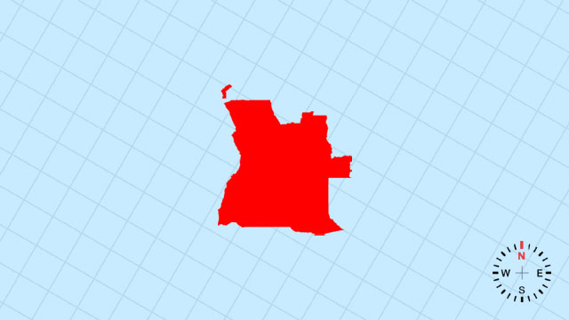
20. Which country’s outline is this?
[C] Angola | A broad, west-sloping rectangle whose Atlantic coast is smooth and eastern edge the straight Congo frontier.
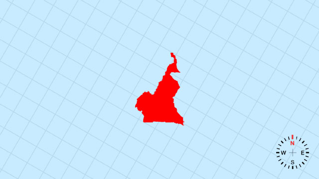
21. Which country’s outline is this?
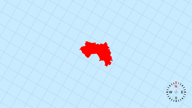
[B] Cameroon | A west-pointing triangle with a small Atlantic nib at Douala and a northern prong reaching toward Lake Chad.
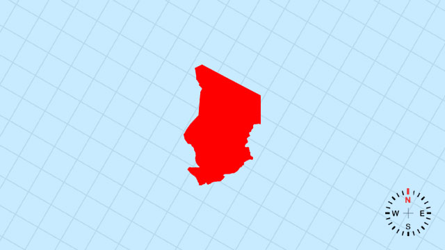
22. Which country’s outline is this?
[B] Chad | A vast, north-south rectangle whose northwestern corner is the sweeping arc of Lake Chad.
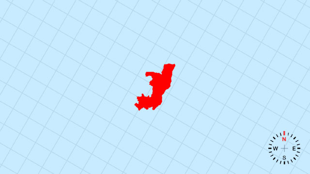
23. Which country’s outline is this?
[C] Republic of the Congo | A compact, west-facing wedge nested west of the Congo River’s great bend.
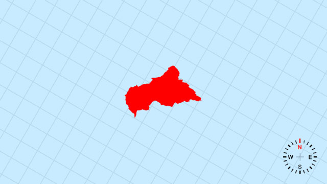
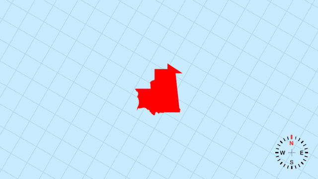
24. Which country’s outline is this?
[C] Central African Republic | A near-perfect diamond locked in the heart of the continent, edges ruler-straight.
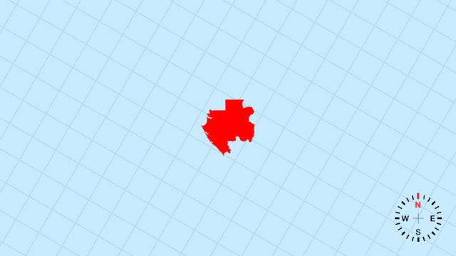
25. Which country’s outline is this?
[D] Gabon | A small, west-tilted rectangle whose Atlantic coast is gentle and eastern frontier the Congo border.
26. Which country’s outline is this?
[C] Equatorial Guinea | A tiny mainland wedge plus Bioko Island, shaped like a dropped comma on the Gulf of Guinea.
27. Which country’s outline is this?
[C] São Tomé and Príncipe | Two volcanic specks straddling the equator off Gabon, like twin commas in the Atlantic.
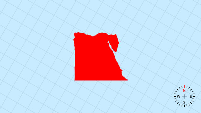
28. Which country’s outline is this?
[A] Egypt | A north-south ribbon along the Nile, flaring into the Nile Delta’s fan at the Mediterranean.
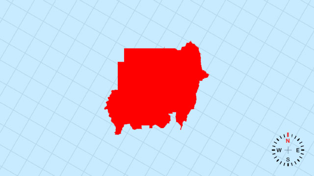
29. Which country’s outline is this?
[A] Sudan | A vast, eastward-sloping rhombus split by the winding Nile and tapering southward.
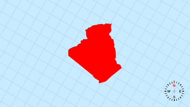
30. Which country’s outline is this?
[D] Algeria | A colossal, west-leaning square whose northern coast curves along the Mediterranean and southern edge fades into the Sahara.
31. Which country’s outline is this?
[C] Morocco | A northwest-tilted rectangle whose western coast is the Atlantic sweep and northern edge the Strait of Gibraltar.
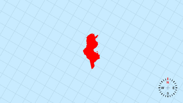
32. Which country’s outline is this?
[C] Tunisia | A compact, eastward-pointing boot kicking out into the Mediterranean toward Sicily.
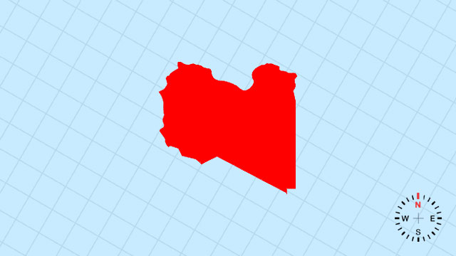
33. Which country’s outline is this?
[D] Libya | A broad, east-west slab along the Mediterranean whose southern half dissolves into endless desert.
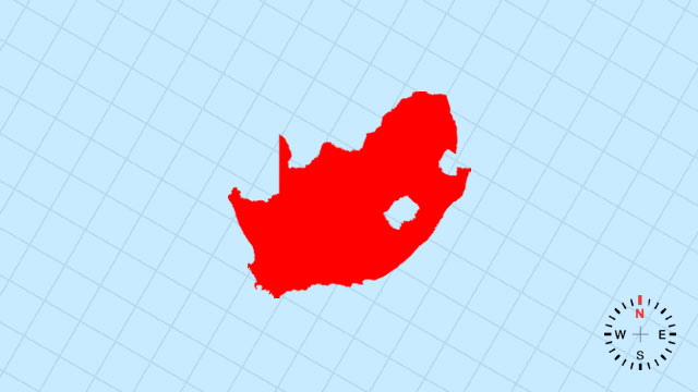
34. Which country’s outline is this?
[A] South Africa | A rugged, south-pointing boot whose Cape is the toe and whose northeastern notch cradles Lesotho.
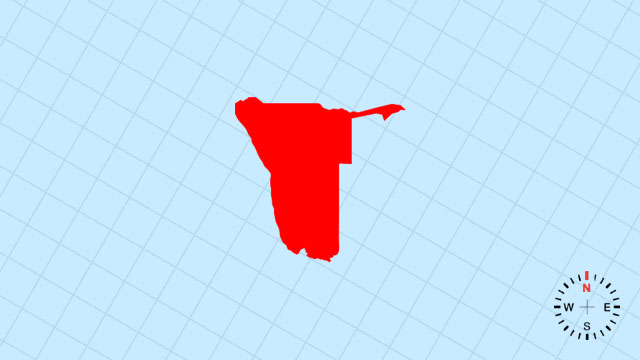
35. Which country’s outline is this?
[D] Namibia | A long, west-sloping rectangle whose Atlantic coast is ruler-straight and eastern edge the Kalahari.
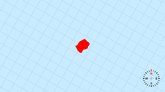
36. Which country’s outline is this?
[B] Lesotho | A tiny, irregular island of highland completely encircled by South Africa’s embrace.
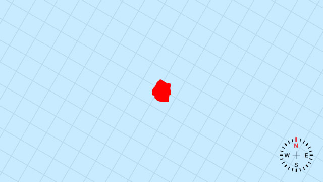
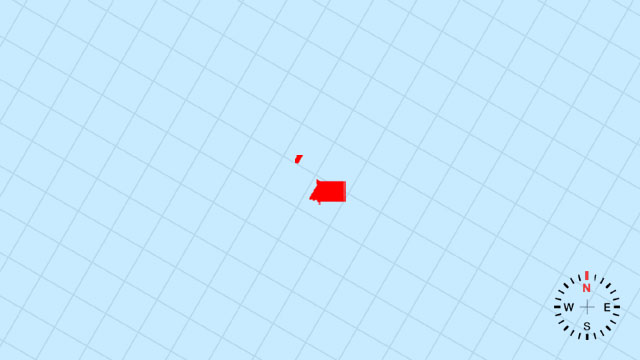
37. Which country’s outline is this?
[C] Eswatini | A petite, north-south sliver tucked between South Africa and Mozambique like a green bookmark.
38. Which country’s outline is this?
[A] Botswana | A broad, eastward-tilting rectangle whose northwest corner is the Okavango Delta’s fan.
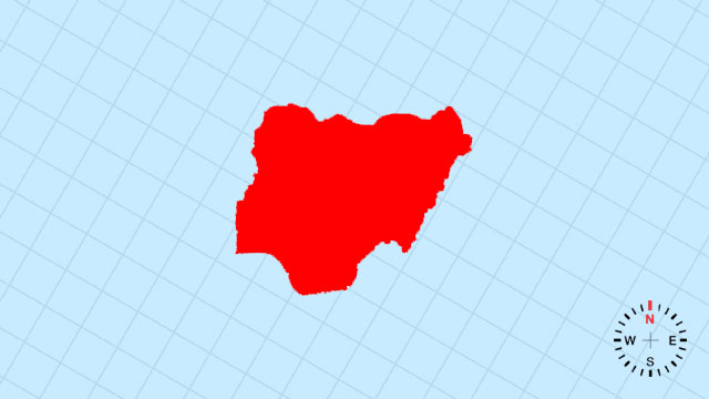
39. Which country’s outline is this?
[A] Nigeria | A compact, south-pointing wedge whose Atlantic coast is the wide Gulf of Guinea bite.
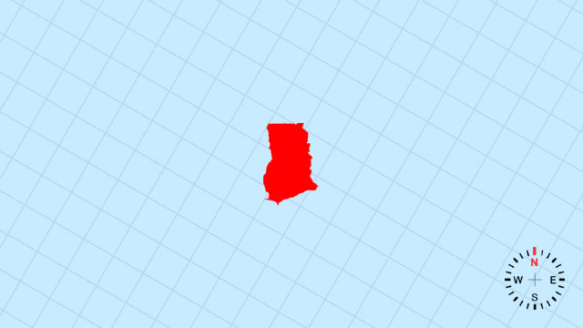
40. Which country’s outline is this?
[A] Ghana | A small, west-east rectangle with a gentle southward bulge along the Gold Coast.
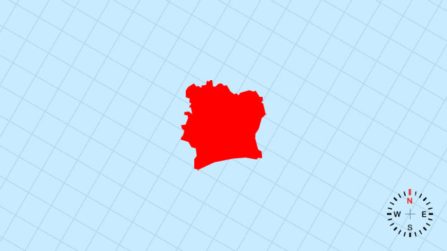
41. Which country’s outline is this?
[D] Côte d'Ivoire | A west-facing triangle whose southern coast curves along the Gulf of Guinea and northern edge straight toward Mali.
42. Which country’s outline is this?
[C] Niger | A vast, eastward-leaning rectangle whose southern curve follows the Niger River bend.
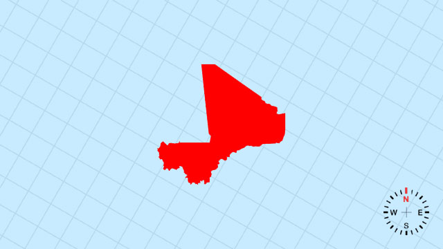
43. Which country’s outline is this?
[B] Mali | A colossal, west-east diamond whose northern tip reaches the Sahara and southern edge the Niger River.
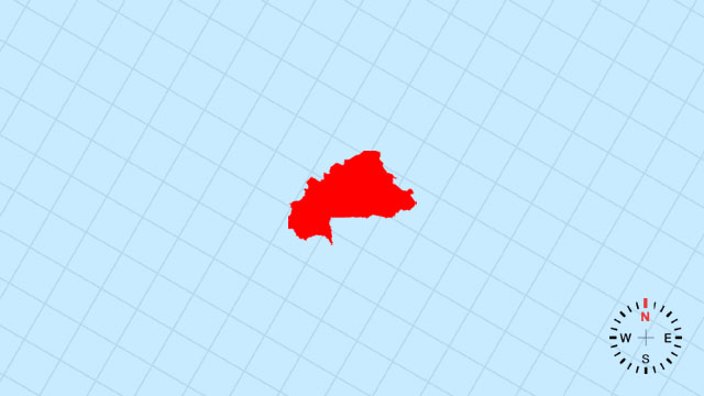
44. Which country’s outline is this?
[A] Burkina Faso | A compact, east-west oval landlocked between the Sahel and the Gulf of Guinea states.
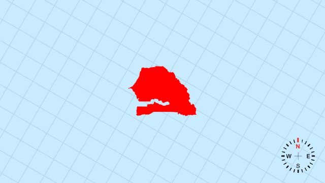
45. Which country’s outline is this?
[B] Senegal | A west-tilting rectangle whose southern coast is the Cape Verde Peninsula’s hook and northern edge the Senegal River.
46. Which country’s outline is this?
[D] Guinea | A broad, west-sloping triangle whose Atlantic coast curves southward and eastern edge rises to the Fouta Djallon.
47. Which country’s outline is this?
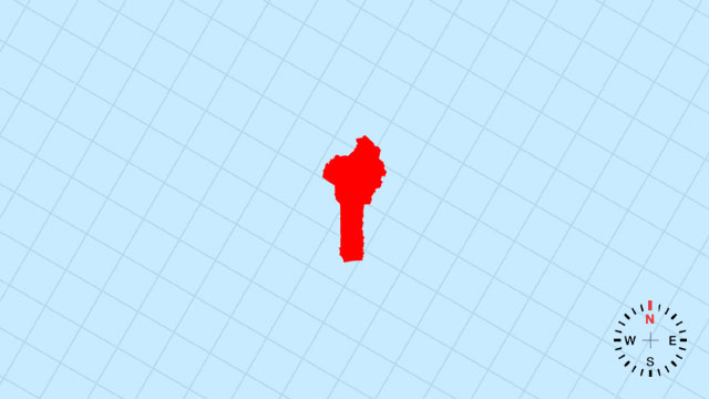
[C] Benin | A slender, north-south sliver with a small Atlantic nub at Cotonou and northern prong toward Niger.
48. Which country’s outline is this?
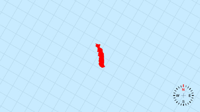
[A] Togo | A tiny, north-south rectangle narrower than its neighbors, its southern coast a gentle Gulf of Guinea scoop.
49. Which country’s outline is this?
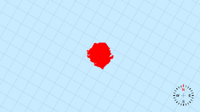
[D] Sierra Leone | A small, west-facing triangle with a deeply indented Atlantic coast shaped like a shark’s fin.
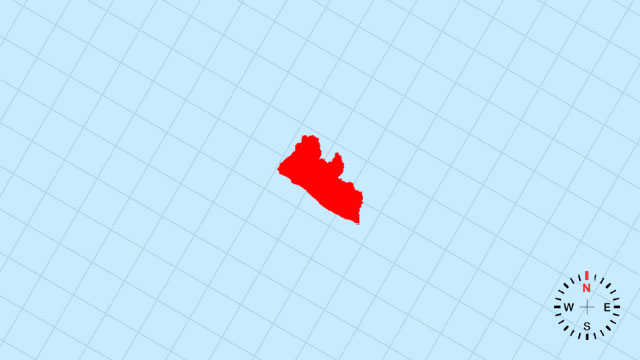
50. Which country’s outline is this?
[A] Liberia | A compact, west-pointing wedge whose Atlantic coast is ragged and eastern edge the straight forest frontier.
51. Which country’s outline is this?
[B] Mauritania | A vast, west-east rectangle whose western coast is the smooth Atlantic and eastern half the endless Sahara.
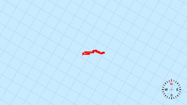
52. Which country’s outline is this?
[A] Gambia | A narrow, west-east sliver following the Gambia River like a needle stitched into Senegal’s side.
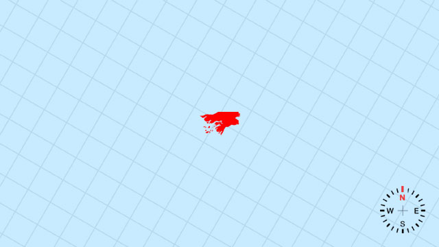
53. Which country’s outline is this?
[A] Guinea-Bissau | A small, west-facing rectangle whose Atlantic coast is deeply serrated by river mouths and islands.
54. Which country’s outline is this?
[C] Cape Verde | A loose ring of volcanic dots in the mid-Atlantic west of Senegal, like scattered salt on a blue table.
Your Scorecard
54 African Map Outline Quiz
- Correct
- Correct Rate%Avg Correct Rate
- L1Difficulty Level1xPoints
- Get Points
- Perfect100%
- Excellent≥90%
- Very Good≥80%
- Good≥70%
- Passed≥60%
- Failed≤50%
Recent Top Players
Related Quizzes
-
![23 North America Map Outline Quiz]()
23 North America Map Outline Quiz
23 QuestionsPlay Quiz -
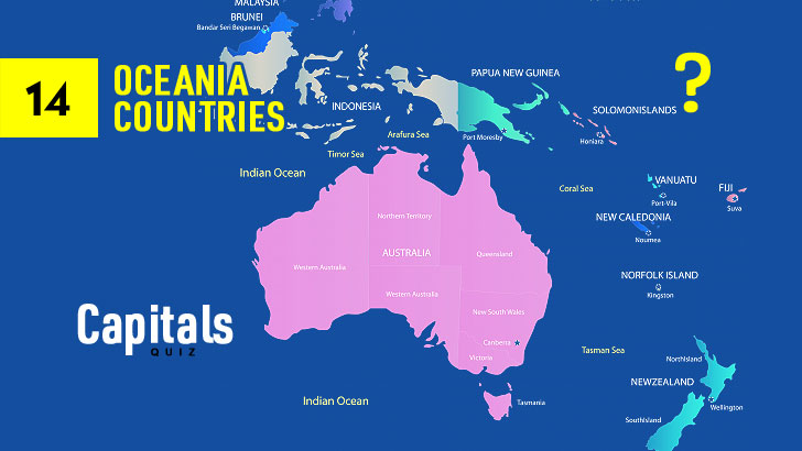
![14 Oceania Map Outline Quiz]()
14 Oceania Map Outline Quiz
14 QuestionsPlay Quiz -
![12 South America Map Outline Quiz]()
12 South America Map Outline Quiz
12 QuestionsPlay Quiz -
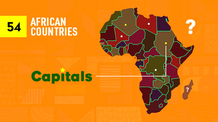
![54 African Capitals Quiz (10s)]()
54 African Capitals Quiz (10s)
54 QuestionsPlay Quiz -
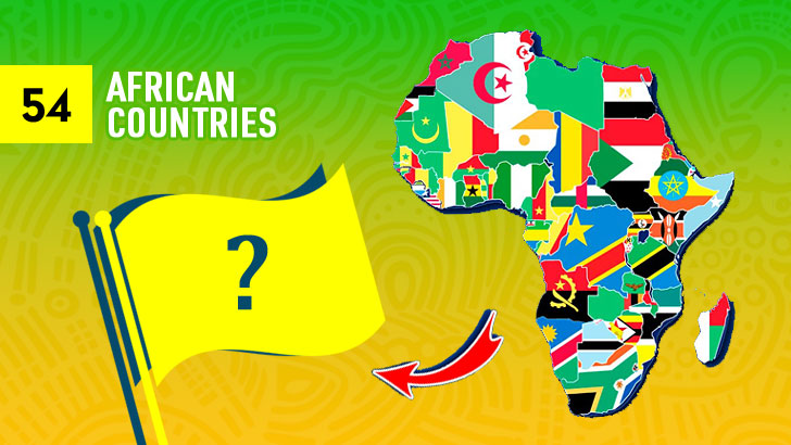
![54 African Flags Quiz (10s)]()
54 African Flags Quiz (10s)
54 QuestionsPlay Quiz -
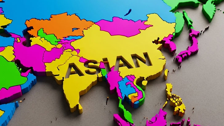
![48 Asian Map Outlines Quiz]()
48 Asian Map Outlines Quiz
48 QuestionsPlay Quiz -
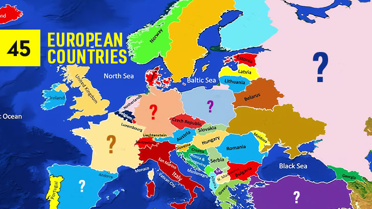
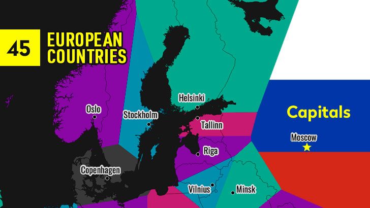
![45 European Map Outlines Quiz]()
45 European Map Outlines Quiz
45 QuestionsPlay Quiz -
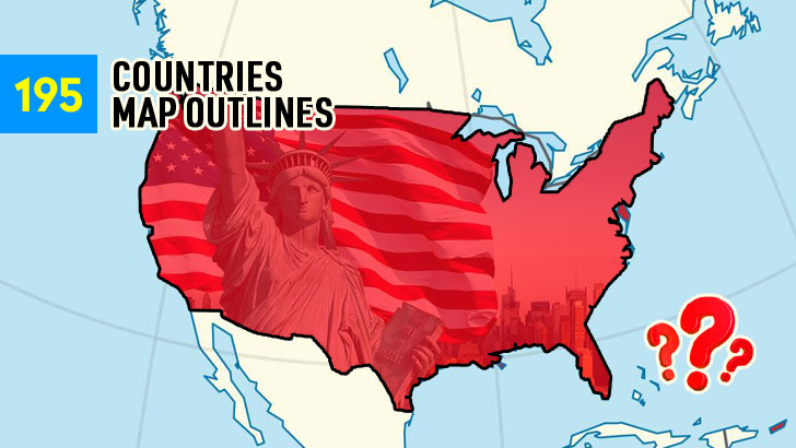
![Guess the 195 Map Outlines (Part 4)]()
Guess the 195 Map Outlines (Part 4)
45 QuestionsPlay Quiz
More from QuizABCD
-
![50 TV Shows Quiz: Recall the Classics]()
50 TV Shows Quiz: Recall the Classics
50 QuestionsPlay Quiz -
![100 Greatest Soccer Players Quiz (Part 3)]()
100 Greatest Soccer Players Quiz (Part 3)
40 QuestionsPlay Quiz -
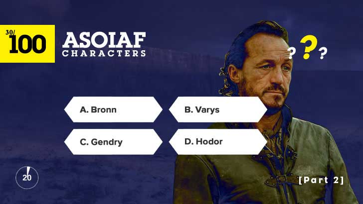
![Name That Westerosi or Bend the Knee (2)]()
Name That Westerosi or Bend the Knee (2)
30 QuestionsPlay Quiz -
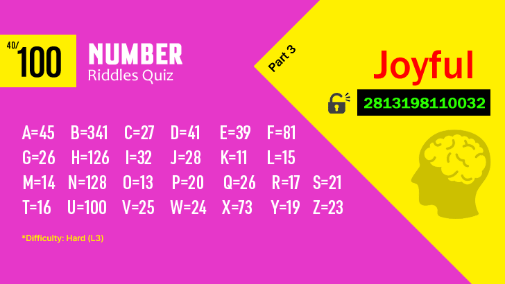
![100 Fun Number Riddles Quiz (L3,3)]()
100 Fun Number Riddles Quiz (L3,3)
40 QuestionsPlay Quiz -
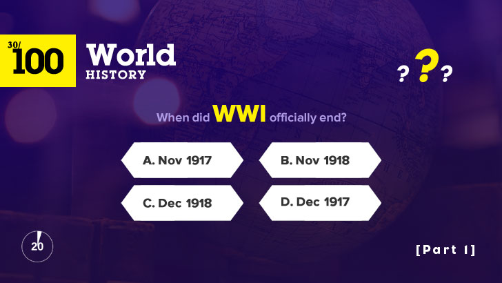
![100 World History Trivia Questions (1)]()
100 World History Trivia Questions (1)
30 QuestionsPlay Quiz -
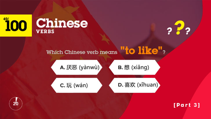
![100 Chinese Verbs Face-Off (Part 3)]()
100 Chinese Verbs Face-Off (Part 3)
40 QuestionsPlay Quiz -
![45 European Capitals Quiz (Blitz, 10s)]()
45 European Capitals Quiz (Blitz, 10s)
45 QuestionsPlay Quiz -
![14 Oceania Capitals Quiz (Blitz, 10s)]()
14 Oceania Capitals Quiz (Blitz, 10s)
14 QuestionsPlay Quiz


Trending Quizzes
This week-
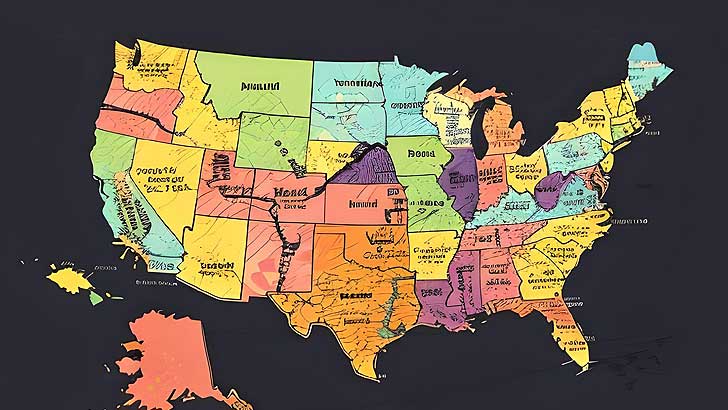
![50 U.S. States Map Quiz (Easy, L1)]()
50 U.S. States Map Quiz (Easy, L1)
000,000 Plays / 0,000 LikesPlay Quiz -
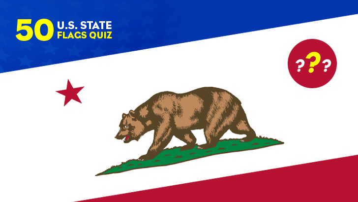
![50 U.S. State Flags Quiz (Easy, L1)]()
50 U.S. State Flags Quiz (Easy, L1)
000,000 Plays / 0,000 LikesPlay Quiz -
![]()
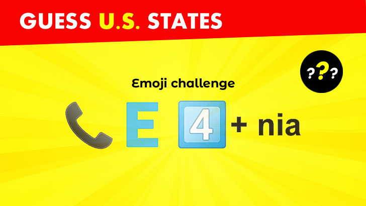
Guess 50 U.S. States from Emojis (1)
000,000 Plays / 0,000 LikesPlay Quiz -
![32 NFL Team Logos Quiz (1)]()
32 NFL Team Logos Quiz (1)
000,000 Plays / 0,000 LikesPlay Quiz -
![30 NBA Team Logos Quiz (1)]()
30 NBA Team Logos Quiz (1)
000,000 Plays / 0,000 LikesPlay Quiz -
![Spot the Differences: Test Your Keen Eye!]()
Spot the Differences: Test Your Keen Eye!
000,000 Plays / 0,000 LikesPlay Quiz -
![]()
Identify 100 Greatest Music Artists Quiz (1)
000,000 Plays / 0,000 LikesPlay Quiz -
![50 Greatest TV Characters Quiz]()
50 Greatest TV Characters Quiz
000,000 Plays / 0,000 LikesPlay Quiz -
![U.S. Presidents Quiz: by Timeline]()
U.S. Presidents Quiz: by Timeline
000,000 Plays / 0,000 LikesPlay Quiz -
![30 Common Chat Acronyms Quiz]()
30 Common Chat Acronyms Quiz
000,000 Plays / 0,000 LikesPlay Quiz