 AI Image
About This Quiz
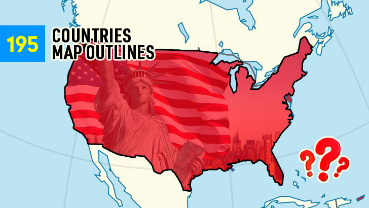
Silhouettes only—neither labels, nor mercy. Only coastlines, corners, and those strange little chew marks where the sea gnaws on the land.
You'll encounter a form that appears broken up in icy fragments far north, and another that stretches like a taper between two large oceans. Islands will attempt to deceive you as well: minuscule dots, hooked bays, chains shaped like necklaces.
A lone outline, four national names, and the clock mocking you in silence. Zoom in your mental map, draw its borders in your eyes, and click before your confidence vanishes.
1. Which country’s outline is this?
[C] Canada | A colossal, north-swept shield whose southern border is ruler-straight and northern coast frays into Arctic islands like torn parchment.
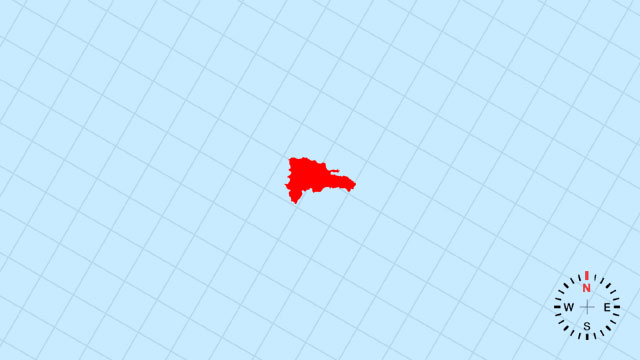
2. Which country’s outline is this?
[B] Dominican Republic | The eastern two-thirds of Hispaniola, a rugged trapezoid tilting eastward toward the Mona Passage.
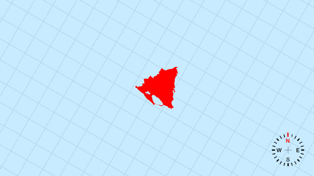
3. Which country’s outline is this?
[A] Nicaragua | A compact, southeast-pointing triangle whose Pacific flank is ruler-straight and whose Caribbean edge is nibbled by the Mosquito Coast.
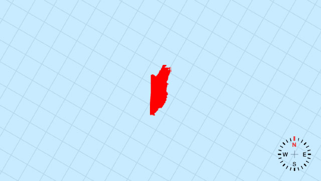
4. Which country’s outline is this?
[D] Belize | A tiny, southeast-tilting wedge tucked under Mexico’s Yucatán jaw, its Caribbean coast gently curved.
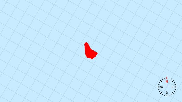
5. Which country’s outline is this?
[C] Barbados | A single coral spearhead standing alone in the Atlantic, its eastern coast pounded into rounded points.
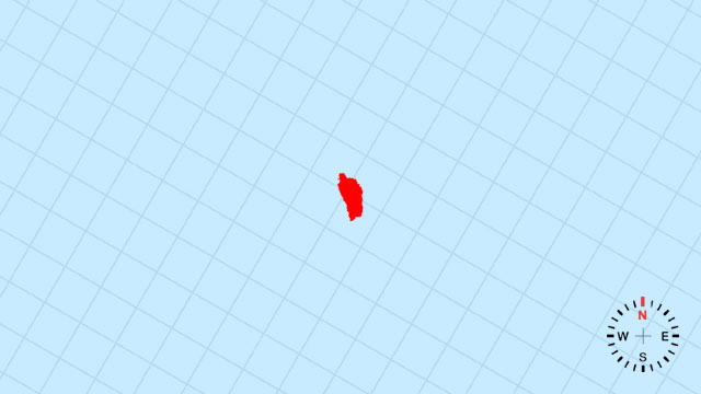
6. Which country’s outline is this?
[B] Dominica | A petite, north-south teardrop of volcanic peaks, its western flank deeply indented by Prince Rupert Bay.
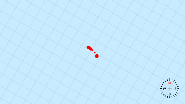
7. Which country’s outline is this?
[A] Saint Kitts and Nevis | A small, comma-shaped pair: the larger Kitts lobe and the tiny Nevis dot, linked by a narrow strait.
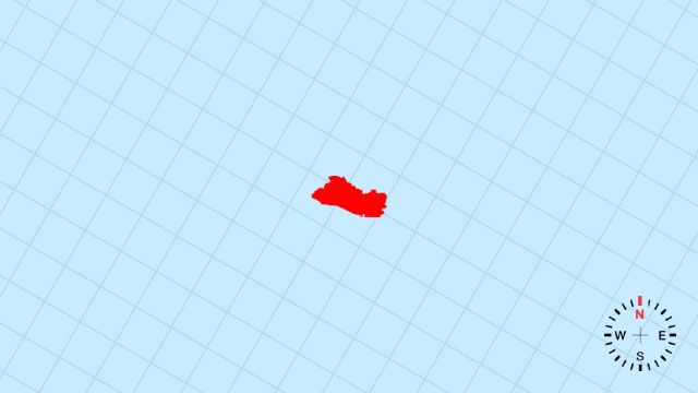
8. Which country’s outline is this?
[D] El Salvador | A compact, west-east ribbon squeezed between Guatemala and Honduras, its Pacific coast ruler-straight.
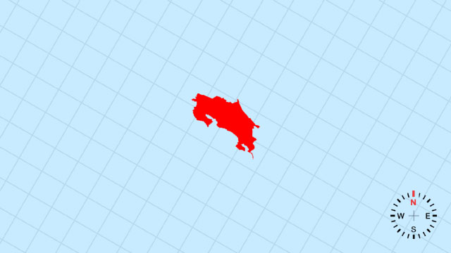
9. Which country’s outline is this?
[A] Costa Rica | A slender, northwest-southeast backbone bridging two seas, its Caribbean side smooth and Pacific edge jagged.
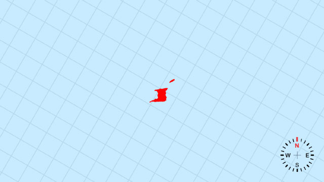
10. Which country’s outline is this?
[B] Trinidad and Tobago | A southward-pointing boot (Trinidad) with a tiny sister comma (Tobago) drifting just northeast.
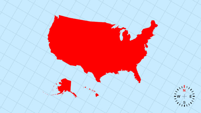
11. Which country’s outline is this?
[C] United States | A vast, west-east rectangle interrupted by the Gulf’s southern scoop and Alaska’s northwest dagger.
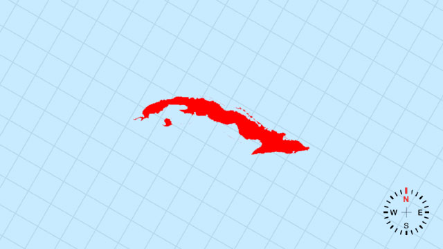
12. Which country’s outline is this?
[C] Cuba | A long, west-curving alligator with its snout at Cabo San Antonio and tail tapering toward the Windward Passage.
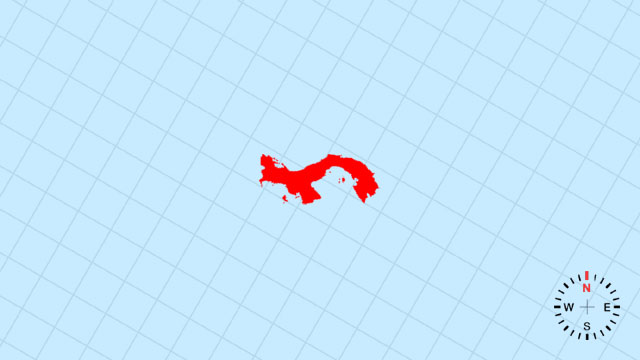
13. Which country’s outline is this?
[D] Panama | A slender, east-west isthmian hinge linking continents, its waist pinched by the canal’s straight slash.
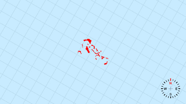
14. Which country’s outline is this?
[C] Bahamas | A loose spray of crescent cays arcing southeast from Florida, like tossed coins across turquoise shallows.
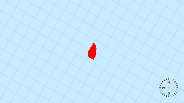
15. Which country’s outline is this?
[B] Saint Lucia | A petite, north-south arrowhead whose southern point aims at Saint Vincent and northern tip kisses Martinique.
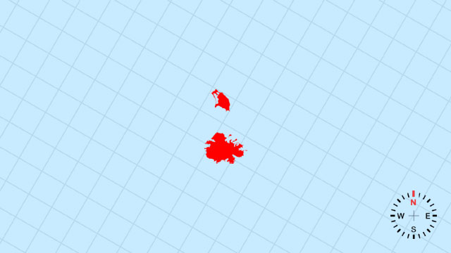
16. Which country’s outline is this?
[A] Antigua and Barbuda | A twin-pearl strand: Antigua’s backward C embracing Barbuda’s flat oval just north.
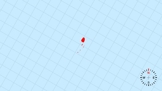
17. Which country’s outline is this?
[C] Saint Vincent and the Grenadines | A volcanic main island followed by a southward string of tiny emerald beads down to Grenada’s doorstep.
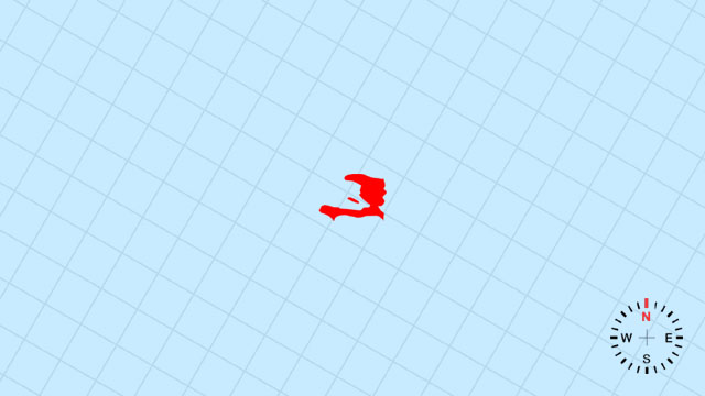
18. Which country’s outline is this?
[A] Haiti | The western half of Hispaniola, a rugged triangle tilting west toward the Windward Passage.
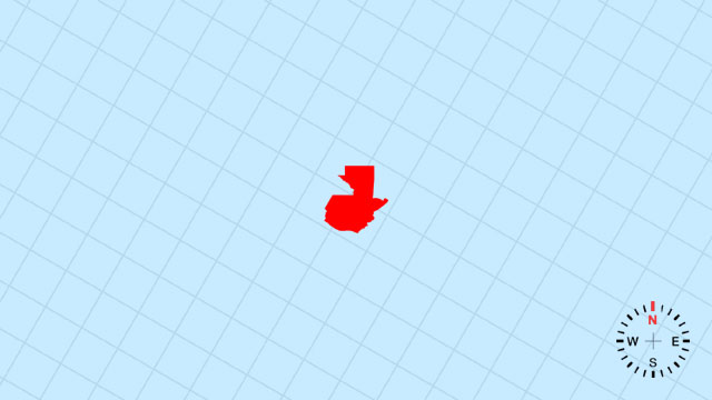
19. Which country’s outline is this?
[A] Guatemala | A compact, west-east wedge broadening northward into the Petén jungle and narrowing to the Pacific coast.
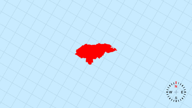
20. Which country’s outline is this?
[D] Honduras | A broad, east-sloping rectangle with a deep Caribbean bite on the north and a short Pacific grin on the south.
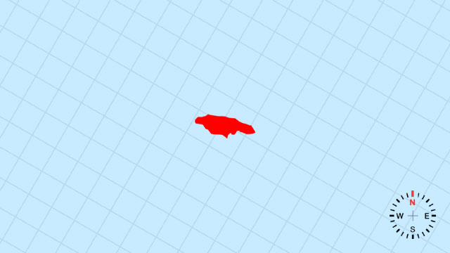
21. Which country’s outline is this?
[A] Jamaica | A west-east running crocodile, its snout at Negril and tail curling east to Morant Point.
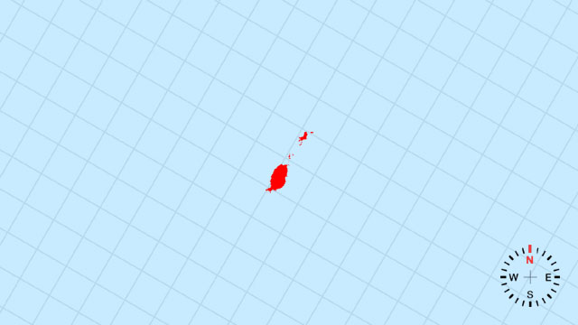
22. Which country’s outline is this?
[B] Grenada | A tiny southern cluster shaped like a clenched fist, its knuckles the main island and outer Grenadines.
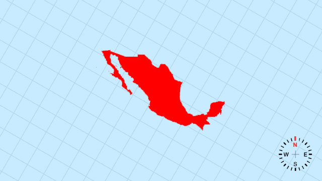
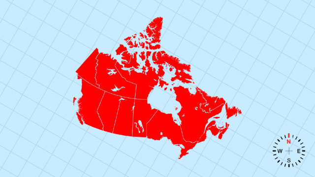
23. Which country’s outline is this?
[B] Mexico | A rugged, northward-tapering horn whose Pacific flank is straight and Gulf coast curves like a scythe against the U.S.
Your Scorecard
23 North America Map Outline Quiz
- Correct
- Correct Rate%Avg Correct Rate
- L1Difficulty Level1xPoints
- Get Points
- Perfect100%
- Excellent≥90%
- Very Good≥80%
- Good≥70%
- Passed≥60%
- Failed≤50%
- 23 North America Map Outline Quiz
- 23 North America Flags Quiz (10s)
- 23 North America Capitals Quiz (10s)
Recent Top Players
Related Quizzes
-
![23 North America Capitals Quiz (10s)]()
23 North America Capitals Quiz (10s)
23 QuestionsPlay Quiz -
![23 North America Flags Quiz (10s)]()
23 North America Flags Quiz (10s)
23 QuestionsPlay Quiz -
![14 Oceania Map Outline Quiz]()
14 Oceania Map Outline Quiz
14 QuestionsPlay Quiz -
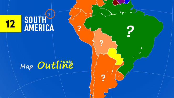
![12 South America Map Outline Quiz]()
12 South America Map Outline Quiz
12 QuestionsPlay Quiz -
![54 African Map Outline Quiz]()
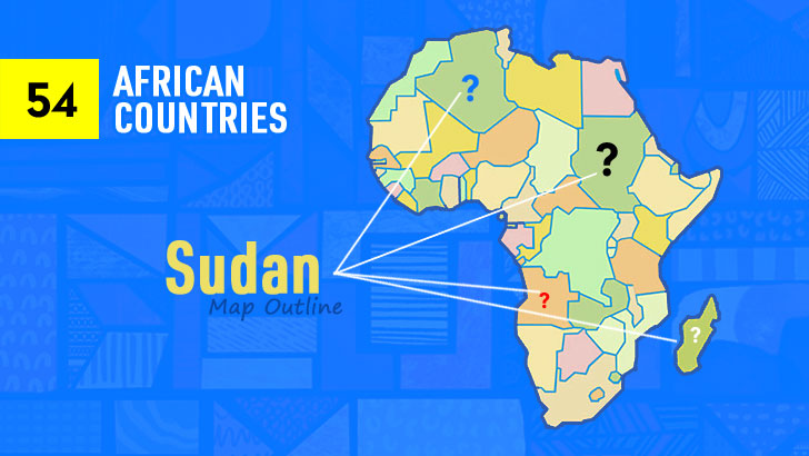
54 African Map Outline Quiz
54 QuestionsPlay Quiz -
![48 Asian Map Outlines Quiz]()
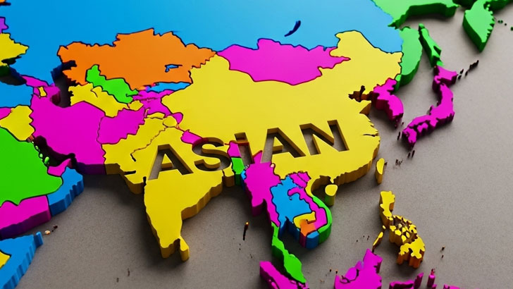
48 Asian Map Outlines Quiz
48 QuestionsPlay Quiz -
![45 European Map Outlines Quiz]()
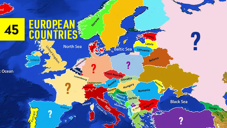
45 European Map Outlines Quiz
45 QuestionsPlay Quiz -
![Guess the 195 Map Outlines (Part 4)]()
Guess the 195 Map Outlines (Part 4)
45 QuestionsPlay Quiz
More from QuizABCD
-
![50 U.S. States Map Quiz (by A-Z)]()
50 U.S. States Map Quiz (by A-Z)
50 QuestionsPlay Quiz -
![96 Best Picture Winners Quiz (2)]()
96 Best Picture Winners Quiz (2)
30 QuestionsPlay Quiz -
![100 Catholicism Trivia Quiz (Easy, 3)]()
100 Catholicism Trivia Quiz (Easy, 3)
40 QuestionsPlay Quiz -
![30 NBA Arenas Quiz: Guess the Home Team]()
30 NBA Arenas Quiz: Guess the Home Team
30 QuestionsPlay Quiz -
![Los Santos Line-Up: ID them all! (Part 1)]()
Los Santos Line-Up: ID them all! (Part 1)
20 QuestionsPlay Quiz -
![100 St. Patrick's Day Trivia Quiz (2)]()
100 St. Patrick's Day Trivia Quiz (2)
30 QuestionsPlay Quiz -
![100 Nintendo Characters Quiz (1)]()
100 Nintendo Characters Quiz (1)
30 QuestionsPlay Quiz -
![Can You Identify 100 Iconic Rock Bands? (1)]()
Can You Identify 100 Iconic Rock Bands? (1)
30 QuestionsPlay Quiz


Trending Quizzes
This week-
![50 U.S. States Map Quiz (Easy, L1)]()
50 U.S. States Map Quiz (Easy, L1)
000,000 Plays / 0,000 LikesPlay Quiz -
![50 U.S. State Flags Quiz (Easy, L1)]()
50 U.S. State Flags Quiz (Easy, L1)
000,000 Plays / 0,000 LikesPlay Quiz -
![]()
Guess 50 U.S. States from Emojis (1)
000,000 Plays / 0,000 LikesPlay Quiz -
![32 NFL Team Logos Quiz (1)]()
32 NFL Team Logos Quiz (1)
000,000 Plays / 0,000 LikesPlay Quiz -
![30 NBA Team Logos Quiz (1)]()
30 NBA Team Logos Quiz (1)
000,000 Plays / 0,000 LikesPlay Quiz -
![Spot the Differences: Test Your Keen Eye!]()
Spot the Differences: Test Your Keen Eye!
000,000 Plays / 0,000 LikesPlay Quiz -
![]()
Identify 100 Greatest Music Artists Quiz (1)
000,000 Plays / 0,000 LikesPlay Quiz -
![50 Greatest TV Characters Quiz]()
50 Greatest TV Characters Quiz
000,000 Plays / 0,000 LikesPlay Quiz -
![U.S. Presidents Quiz: by Timeline]()
U.S. Presidents Quiz: by Timeline
000,000 Plays / 0,000 LikesPlay Quiz -
![30 Common Chat Acronyms Quiz]()
30 Common Chat Acronyms Quiz
000,000 Plays / 0,000 LikesPlay Quiz