 AI Image
About This Quiz
Map limbo, Pacific edition. Two rickety islands leaning into one another? File that away. A continent-shaped oval lounging south like a sated feline? Difficult to overlook. And then there are the speckled chain gangs—atolls spread about like ticker tape.
Cute is confidence; accurate takes the win. Count the primary islands, search for that barrier reef halo, and determine if the silhouette appears bird-esque, toothy, or nice and round. In case it appears obvious, double-take (the neighbors plagiarize homework out here).
Click steadily, zoom if possible, and let muscle memory take it from there. When coastlines begin humming their names, you'll be island-hopping without getting out of your chair.
1. Which country’s outline is this?
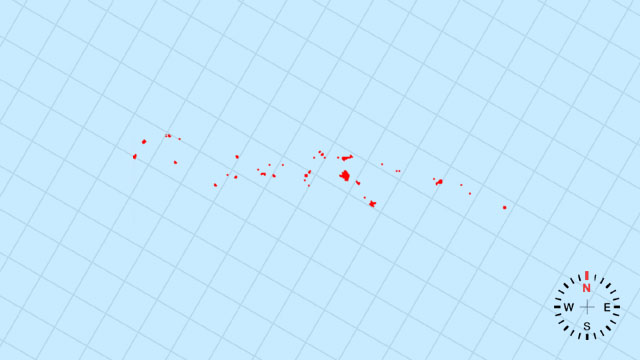
[A] Solomon Islands | A loose double chain of emerald shards scattered in a gentle northwest arc across the Coral Sea.
2. Which country’s outline is this?
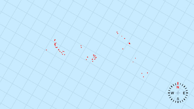
[B] Vanuatu | A curved, south-sweeping scythe of volcanic islets, blades glinting between Fiji and New Caledonia.
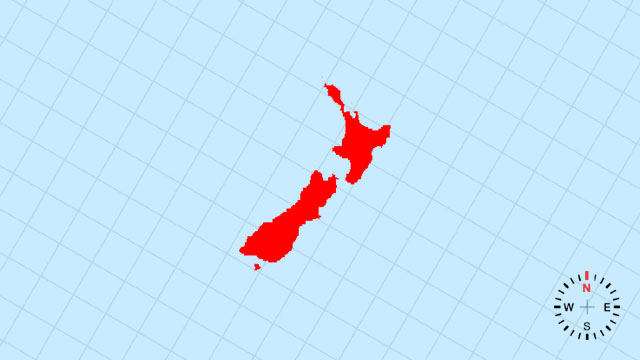
3. Which country’s outline is this?
[C] New Zealand | Two long, tilted vertebrae—North Island’s fishhook and South Island’s jagged backbone—separated by Cook Strait.
4. Which country’s outline is this?
[A] Marshall Islands | Two parallel coral necklaces of microscopic atolls strung across the central Pacific like scattered pearls.
5. Which country’s outline is this?
[D] Palau | A tiny western cluster of limestone and volcanic specks, shaped like a broken comma at the edge of the Philippine Sea.
6. Which country’s outline is this?
[B] Fiji | A V-shaped bouquet of islands whose eastern wing points at Tonga and western stem brushes the Melanesian chain.
7. Which country’s outline is this?
[C] Australia | A vast, south-tilted slab of red heartland ringed by a thin green coastal rim and an empty centre like a dried lake.
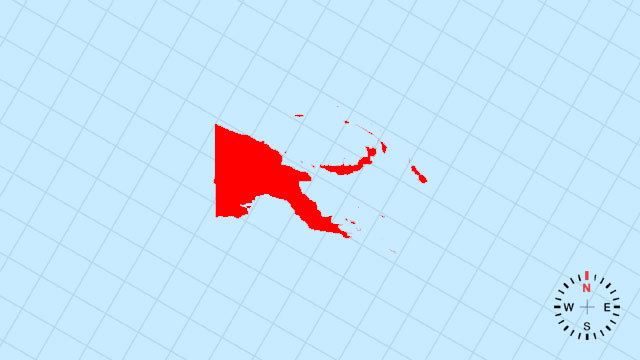
8. Which country’s outline is this?
[B] Papua New Guinea | A towering eastern half of New Guinea island, its northern coast deeply serrated by fjord-like bays and its tail curling toward the Solomons.
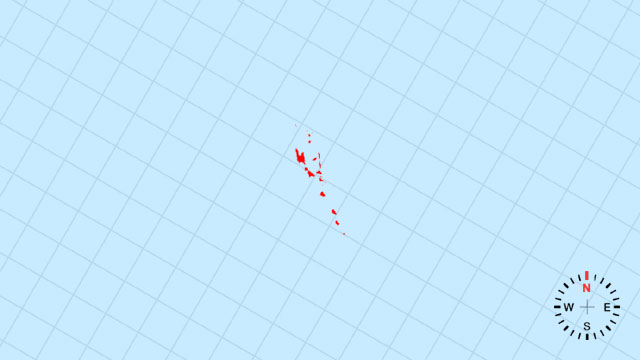
9. Which country’s outline is this?
[D] Tonga | A north-south arc of volcanic crowns and coral rings, like stepping-stones across the southern Pacific.
10. Which country’s outline is this?
[A] Micronesia | A loose constellation of four island groups strewn across the western Pacific, each dot barely larger than its reef.
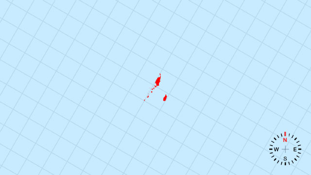
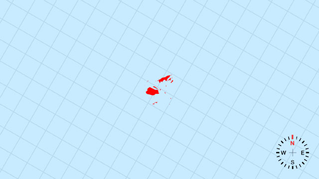
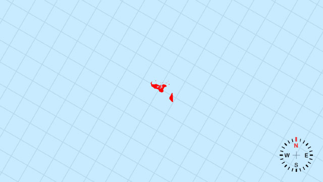
11. Which country’s outline is this?
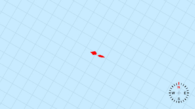
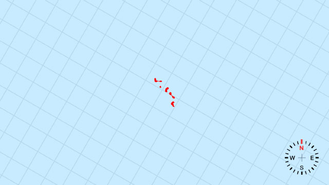
[D] Samoa | Two main volcanic commas lying east-northeast, their southern coasts gently scooped by lagoons.
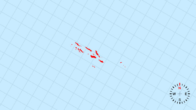
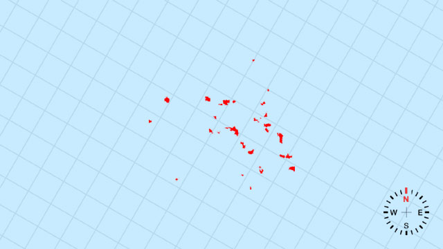
12. Which country’s outline is this?
[C] Kiribati | A vast equatorial ribbon of coral dots stretching 5,000 km east-west, so thin it almost disappears on the globe.
13. Which country’s outline is this?
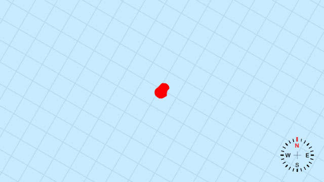
[B] Nauru | A single, raised coral speck—barely a pinhead—south of the equator, ringed by a narrow reef.
14. Which country’s outline is this?
[D] Tuvalu | A tight cluster of nine coral atolls forming a fragile necklace just south of the equator, each link barely above the waves.
Your Scorecard
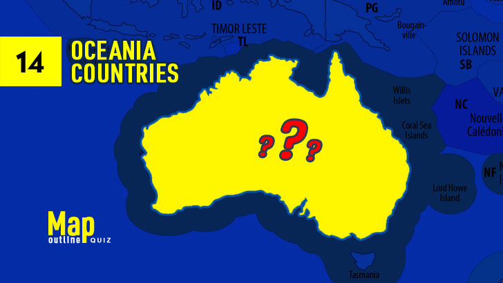
14 Oceania Map Outline Quiz
- Correct
- Correct Rate%Avg Correct Rate
- L1Difficulty Level1xPoints
- Get Points
- Perfect100%
- Excellent≥90%
- Very Good≥80%
- Good≥70%
- Passed≥60%
- Failed≤50%
- 14 Oceania Map Outline Quiz
- 14 Oceania Flags Quiz (Blitz, 10s)
- 14 Oceania Capitals Quiz (Blitz, 10s)
Recent Top Players
Related Quizzes
-
![23 North America Map Outline Quiz]()
23 North America Map Outline Quiz
23 QuestionsPlay Quiz -
![14 Oceania Capitals Quiz (Blitz, 10s)]()
14 Oceania Capitals Quiz (Blitz, 10s)
14 QuestionsPlay Quiz -
![14 Oceania Flags Quiz (Blitz, 10s)]()
14 Oceania Flags Quiz (Blitz, 10s)
14 QuestionsPlay Quiz -
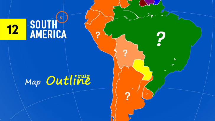
![12 South America Map Outline Quiz]()
12 South America Map Outline Quiz
12 QuestionsPlay Quiz -
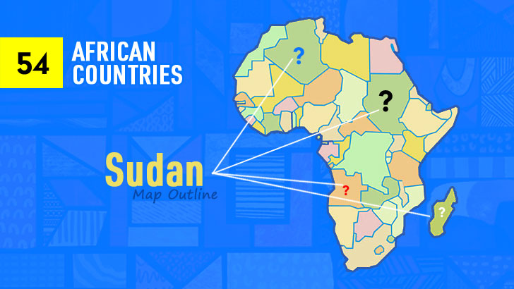
![54 African Map Outline Quiz]()
54 African Map Outline Quiz
54 QuestionsPlay Quiz -
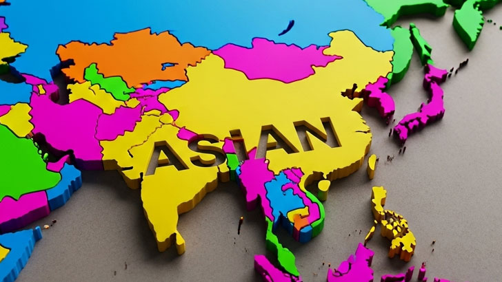
![48 Asian Map Outlines Quiz]()
48 Asian Map Outlines Quiz
48 QuestionsPlay Quiz -
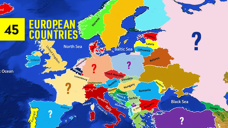
![45 European Map Outlines Quiz]()
45 European Map Outlines Quiz
45 QuestionsPlay Quiz -
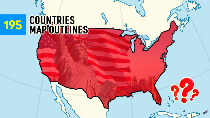
![Guess the 195 Map Outlines (Part 4)]()
Guess the 195 Map Outlines (Part 4)
45 QuestionsPlay Quiz
More from QuizABCD
-
![Can You Identify 100 Iconic Rock Bands? (3)]()
Can You Identify 100 Iconic Rock Bands? (3)
40 QuestionsPlay Quiz -
![100 Greatest Actors Quiz (Part 3)]()
100 Greatest Actors Quiz (Part 3)
40 QuestionsPlay Quiz -
![100 Star Trek Characters Quiz (Part 1)]()
100 Star Trek Characters Quiz (Part 1)
30 QuestionsPlay Quiz -
![Can You Moonwalk Through This MJ Trivia? (1)]()
Can You Moonwalk Through This MJ Trivia? (1)
30 QuestionsPlay Quiz -
![Spot the South Park Character in One Frame (1)]()
Spot the South Park Character in One Frame (1)
30 QuestionsPlay Quiz -
![Quiz: Name These 100 Dishes (Part 3)]()
Quiz: Name These 100 Dishes (Part 3)
40 QuestionsPlay Quiz -
![100 World History Trivia Questions (2)]()
100 World History Trivia Questions (2)
30 QuestionsPlay Quiz -
![20 U.S. Holidays Quiz (Blitz, 10s)]()
20 U.S. Holidays Quiz (Blitz, 10s)
20 QuestionsPlay Quiz


Trending Quizzes
This week-
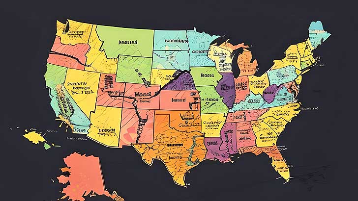
![50 U.S. States Map Quiz (Easy, L1)]()
50 U.S. States Map Quiz (Easy, L1)
000,000 Plays / 0,000 LikesPlay Quiz -
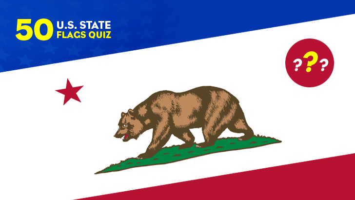
![50 U.S. State Flags Quiz (Easy, L1)]()
50 U.S. State Flags Quiz (Easy, L1)
000,000 Plays / 0,000 LikesPlay Quiz -
![]()
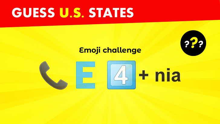
Guess 50 U.S. States from Emojis (1)
000,000 Plays / 0,000 LikesPlay Quiz -
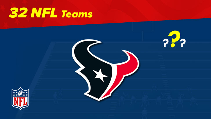
![32 NFL Team Logos Quiz (1)]()
32 NFL Team Logos Quiz (1)
000,000 Plays / 0,000 LikesPlay Quiz -
![30 NBA Team Logos Quiz (1)]()
30 NBA Team Logos Quiz (1)
000,000 Plays / 0,000 LikesPlay Quiz -
![Spot the Differences: Test Your Keen Eye!]()
Spot the Differences: Test Your Keen Eye!
000,000 Plays / 0,000 LikesPlay Quiz -
![]()
Identify 100 Greatest Music Artists Quiz (1)
000,000 Plays / 0,000 LikesPlay Quiz -
![50 Greatest TV Characters Quiz]()
50 Greatest TV Characters Quiz
000,000 Plays / 0,000 LikesPlay Quiz -
![U.S. Presidents Quiz: by Timeline]()
U.S. Presidents Quiz: by Timeline
000,000 Plays / 0,000 LikesPlay Quiz -
![30 Common Chat Acronyms Quiz]()
30 Common Chat Acronyms Quiz
000,000 Plays / 0,000 LikesPlay Quiz